
College of Agriculture and Natural Resources
Center for Land Use Education and Research

What is the Connecticut's Changing Landscape Land Cover Map Series?
Can I download the Landscape Fragmentation Tool and use it in my GIS with my own settings?
What are the definitions of the classes that appear on the forest fragmentation and change maps?
Why does it seem that more core forest is lost than total forest? How can that be?
Q. What is the Connecticut' Changing Landscape Land Cover Map Series?
A. The Connecticut's Changing Landscape Land Cover Map Series (Version 2) consists of five dates of land cover data (1985, 1990, 1995, 2002 and 2006) created from satellite imagery. Each dataset includes twelve consistently interpreted land cover categories. The data were produced in a way to ensure easy comparison, especially for land cover change studies. The land cover data are available in digital format for use in Geographic Information Systems and can be used to produce a wide variety of map products.
Q. How were the forest fragmentation map created?
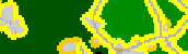
A. A computer model was used to create the forest fragmentation maps from land cover based on a procedure developed by Vogt et al., 2007. The model classifies forest pixels into four main classes: 1) patch forest, 2) edge forest, 3) perforated forest, and 4) core forest. Visit the Landscape Fragmentation Tool website to learn more about how it works.
The patch forest consists of small forest fragments in which all pixels are less than 100 meters (300 ft) from a fragmenting feature. Core forest pixels are more than 100 meters (300ft) from fragmenting features. The peripheries of tracts containing core forest pixels are classified into edge and perforated forest. These peripheral forest classes are within 100 meters (300 ft) of fragmenting features. The edge forest is found along the outside edge of the tracts whereas the perforated forest is found along the inside edge of small forest gaps. Contiguous areas of core forest are further classified based on the area of the core patch. The core forest is divided into three classes: 1) small core patches less than 250 acres, 2) medium core patches 250-500 acres, and 3) large core patches greater than 500 acres.
Q. What are considered fragmenting features?
A. All non-forest land covers divide forest up into smaller, more isolated patches and thus fragment the forest. However, the forest fragmentation maps are intended to highlight the forest fragmentation caused by human modifications of the environment. When creating the maps, we considered the following land cover classes to be fragmenting features: developed, turf and grass, other grasses, agricultural field, barren, and utility corridor. Maps using a different set of land cover types for the fragmenting features can be created using the Landscape Fragmentation Tool.
Q. How did you pick 250 and 500 acres for core classes?
A. Studies of forest species have found that smaller forest patches are unable to support the diversity of interior forest species found in larger forest patches. A study by Natural Resources Canada summarized these findings and provided information on the percent of interior forest species that can be supported by patches of given areas. We used the thresholds provided in this study to classify the core forest patches. According to the study, forest patches with areas of 250 and 500 acres can support 60 and 80 percent, respectively, of the interior forest species found in the region. The thresholds used by the study include the edge forests in the patch area calculations. Since our core forest class does not include edge forest area, our sub-classification of the core forest is on the conservative side. More information on the relationship between forest patch area and patch viability can be found at: http://sof.eomf.on.ca/Biological_Diversity/Ecosystem/Fragmentation/Indicators/Size/i_wooded_patch_size_by_watershed_e.htm
Q. Can I download the Landscape Fragmentation Tool and use it in my GIS with my own settings?
A. The Landscape Fragmentation Tool is available for download. The tool allows the user to specify the input land cover data to be used as well as the edge widths that define the patch, edge, and perforated forests. The input land cover can be based on any land cover dataset including Connecticut's Changing Landscape and the National Land Cover Dataset (NLCD). By reclassifying the input land cover, the user can control the land cover type of interest as well as the fragmenting features. See the Landscape Fragmentation Tool webpage for more details.
Q. How can I view the forest fragmentation maps?
A. Beyond viewing static maps on the Statewide page and Your Town and Your Watershed pages, there are three ways on the web site to view the actual maps:
Each way has different features outlined in the table below. Click the title to jump to a choice.
| PDFs | Interactive Map | Download Data | |
| Software Required | Adobe Reader* | Web Browser (internet explorer, firefox, etc.) | GIS Software |
| GIS Expertise Required | None | None | Some |
| Allows for Zooming | To some degree | Yes | Yes, in GIS software after download |
| Allows for Printing | Yes, although format is for 8.5 x 11 paper | Yes, prints the view allowing for smaller geographic regions | Yes, within GIS software |
| Data can be viewed with your own GIS data | No | If you connect to the service using a GIS | Yes |
| Geographic Coordinates maintained | No | Yes | Yes |
| Ability to turn on/off and compare maps | No. Multiple pdfs can be opened in different browsers, but not easily compared | Yes | Yes in a GIS |
* Adobe reader can be downloaded for free at http://www.adobe.com/products/acrobat/readstep2.html.
Q. Is the Forest Fragmentation data correct?
A. The procedure used to create the Forest Fragmentation data is based on the latest available research by the U.S., Canadian, and European Forest Service agencies. The 100 meter (300 ft) edge width zone, used in the maps, is often used for general purpose fragmentation analyses but it is not necessarily correct for all applications. Studies in the ecological literature have found edge width zones to range from 25 meters to several hundred meters depending on the species being studied. The appropriateness of the edge width used in the Forest Fragmentation maps should be considered for the species or issue of interest. Maps using different edge widths can be generated using the Landscape Fragmentation Tool. The Forest Fragmentation maps are only as accurate as the land cover data on which they are based.
Q. How do you calculate change?
A. In this kind of research, there are three ways to measure change as described in the table below. The percent change reported in the data tables on the Your Town and Your Watershed pages is the Relative rate of change. This means that if there is a small area to begin with (little area in time 1, or 1985), then the relative rate is likely to be high (or high percentage). If there is a large area to begin with (lots of area in time 1, or 1985), then the relative rate is likely to be low (a small percentage).
The percent change reported in the data table on the Statewide page is the Relative change.
T stands for a time period, so T1 would be an earlier date than T2. In most data tables on this website, T1 is 1985 and T2 is 2006.
| Measure of land cover change | Unit | Calculation | Significance |
| Absolute change | area, such as acres | (acres T2 – acres T1) | Allows aggregation of total areal change across the same geographic areas (such as towns or basins) |
| Relative change | percent | (% area T2 - % area T1) | Allows comparison between areas (such as towns or basin); relates to land cover indicators |
| Relative rate of change | percent | (area T1 - area T2) / area T1 | Gives feel for how quickly land cover is changing relative to 1985 baseline, within and between the same geographic area |
Q. How were the land cover data created?
A. The land cover data were produced from Landsat satellite images using a computer application called image processing. Landsat images are made up of millions of small squares called pixels. Each pixel represents an area on the ground that measures 30 meters by 30 meters (about 100ft by 100ft). For each pixel, the Landsat image records the amount of reflected energy in 6 narrow bands of the electromagnetic spectrum (red, green and blue visible light, a near-infrared and two mid-infrared bands). Because landscape features reflect light differently, we can use reflectance data to identify areas of deciduous forest, coniferous forest, water, etc. This is where the image processing software is so helpful. Rather than you or me having to analyze data for each pixel, the software can do it much faster, and with the help of image analysts, can assign pixels to land cover classes based on differences and/or similarities in reflectance values. For details about image processing methods used, visit The Project page.
Q. Is the land cover data correct?
A. Of course we'd like to think that the datasets are error free but the reality is that there are misclassification errors. A great deal of time was spent to avoid and correct errors. A variety of ancillary data sources such as USGS topographic maps and orthophotos, were used to aid the classification process. An accuracy assessment is under way so that we can quantitatively assess the accuracy of each land cover map. However, as of September 2009, we have not yet completed the accuracy assessment.
Q. Where can I get a copy of the forest fragmentation data?
A. Visit the data download page of this website.
Q. Why does it seem that more core forest is lost than total forest? How can that be?
A. Let's look at how these figures are calculated.
Total Core Forest Change is a combination of the change in small core forest, medium core forest and large core forest. Each of these changes is negative so the total change (loss, really) in core forest is a large negative number.
Total Forest Change is a combination of all of the forest classes including patch forest, edge forest, perforated forest, and small, medium and large core forest. Because some forest classes actually gain area (patch and perforated) while the rest loose area, the total change is a smaller negative number than the core forest change (above).
| FAQ | Caution! | 1985 | 2006 | Change | ||||
| sq. miles | % of state | sq. miles | % of state | sq. miles | % change | ||
| Patch Forest | 233 | 4.7% | 258 | 5.2% | 26 | 0.5% | |
| Edge Forest | 1109 | 22.3% | 1107 | 22.3% | -3 | -0.1% | |
| Perforated Forest | 145 | 2.9% | 201 | 4.0% | 56 | 1.1% | |
| Small Core Forest | 433 | 8.7% | 411 | 8.3% | -22 | -0.4% | |
| Medium Core Forest | 297 | 6.0% | 234 | 4.7% | -64 | -1.3% | |
| Large Core Forest | 890 | 17.9% | 711 | 14.3% | -179 | -3.6% | |
| Total Core Forest | 1620 | 32.6% | 1356 | 27.3% | (-22) + (-64) + (-179) = | -264 | -3.6% |
| Total Forest | 3107 | 62.5% | 2922 | 58.8% | 26 + (-3) + 56+ (-22) + (-64) + (-179) = | -185 | -3.7% |
