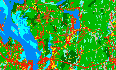
Land Cover
1985, 1990, 1995, 2002, 2006How much have we developed, and at what rate? LEARN MORE
Basic Land Cover Information Showing Changes to the Landscape Since 1985Changing Landscape is a remote sensing-based land cover study that charts landscape changes in Connecticut and portions of New York. It covers the 25-year period from 1985 to 2010 (with in-between dates of 1990, 1995, 2002 and 2006). It includes information on basic land cover, as well as subsidiary analyses of riparian corridor land cover, impervious cover and agricultural field and soil analysis. The Connecticut's Changing Landscape focuses on Connecticut towns. The Long Island Sound Watershed's Changing Landscape focuses on watersheds in Connecticut and New York that drain into Long Island Sound. |
Visit the award winning story map! It tells the story of Connecticut's Changing landscape in an interactive, graphic and map format. Learn more about the story map here.
|
Connecticut's Changing Landscape
Analysis for Connecticut and Connecticut towns through 2006. This will be updated, included 2015, when the land cover and funds are available.

How much have we developed, and at what rate? LEARN MORE

How much have we developed, and at what rate? LEARN MORE

Results of the Forest Fragmentation tool where forested land is divided into categories, such as core forest and edge forest. LEARN MORE

Land cover and land cover change within the Riparian, or stream-side, areas of Connecticut. LEARN MORE

An analysis of the status and trends of agricultural fields in Connecticut, and how they relate to the statewide data on agricultural soils of importance. LEARN MORE