College of Agriculture and Natural Resources
Center for Land Use Education and Research

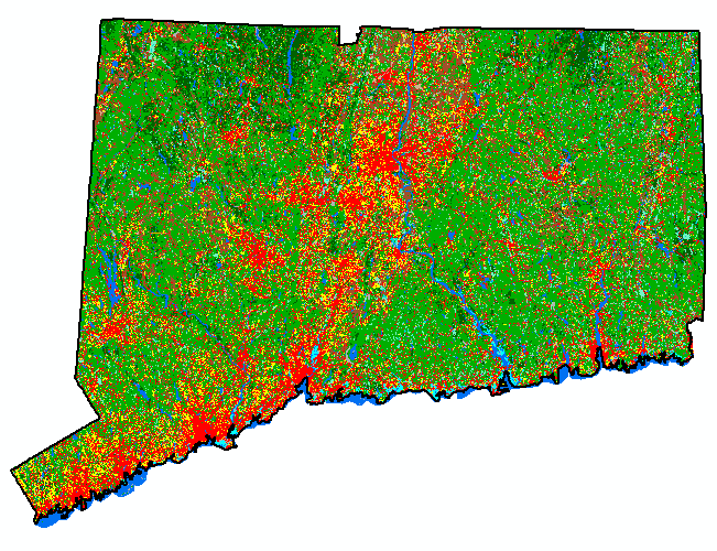
Choose a category below to see land cover maps for all study dates, town-by-town maps showing various types of land cover change, and a number of charts and tables summarizing statewide data.
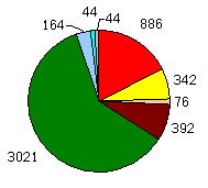
1985 Statewide Land Cover |
|
|
 |
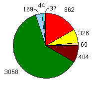
1990 Statewide Land Cover |
|
|
|
1995 Statewide Land Cover |
|
|
|
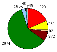
2002 Statewide Land Cover |
|
|
|
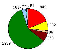
2006 Statewide Land Cover |
|
|
|
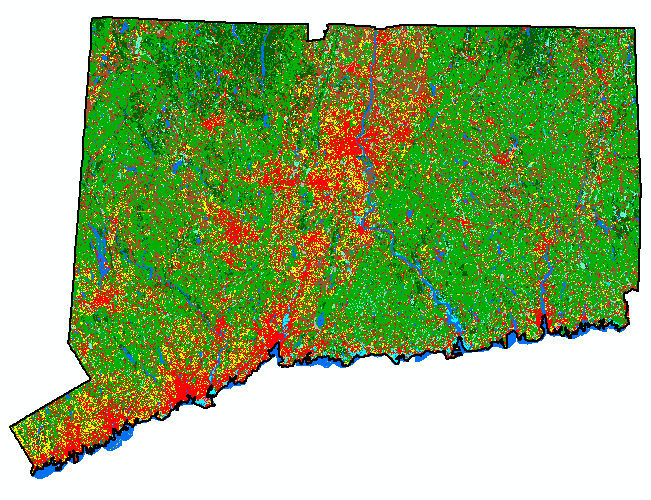
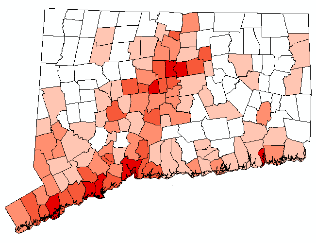
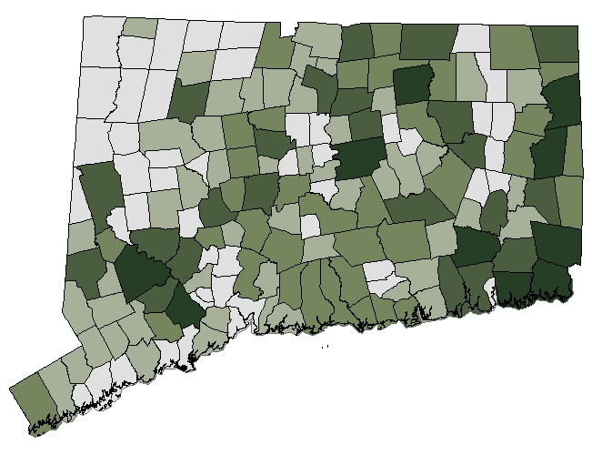
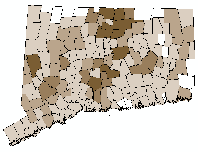
Percent Developed in 1985 |
|
 |
|
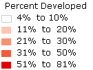
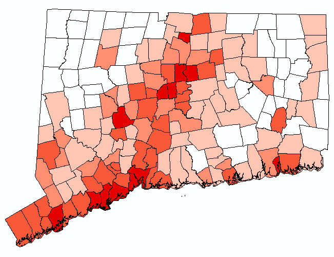
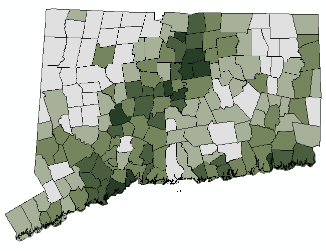
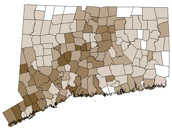
Percent Developed in 2006 |
|
 |
|
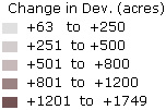
Change in Developed 1985 to 2006 (acres) |
|
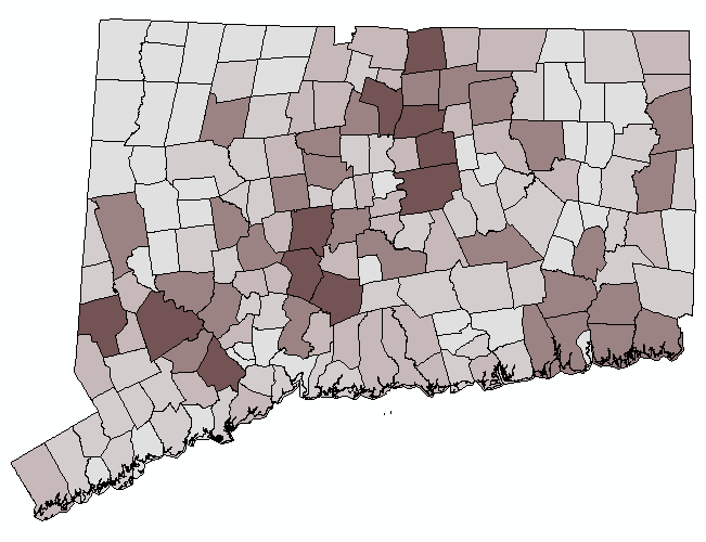 |
The area (in acres) of Developed for each municipality in 1985 was compared to the area (in acres) of Developed for each municipality in 2006. The municipalities are then colored based on the change, in acres, as shown in the legend (above). Note that there is a bias to the larger towns that have more acres. |
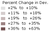
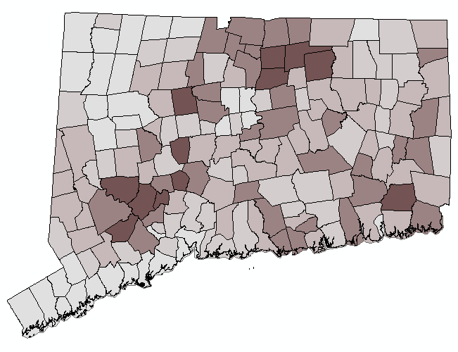
Percent Change in Developed 1985 to 2006 |
|
 |
|
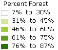
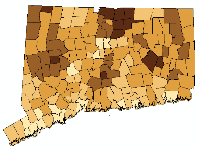
Percent Forest in 1985 |
|
 |
|
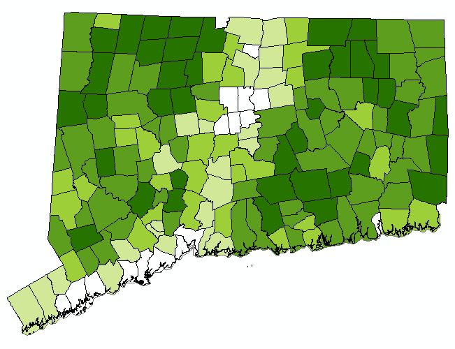
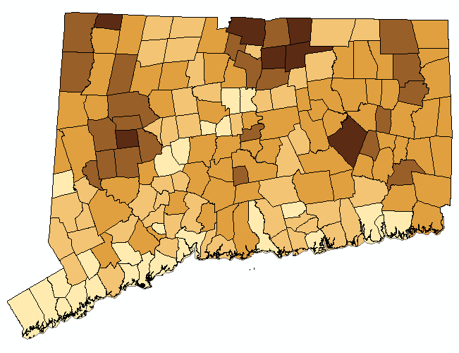
Percent Forest in 2006 |
|
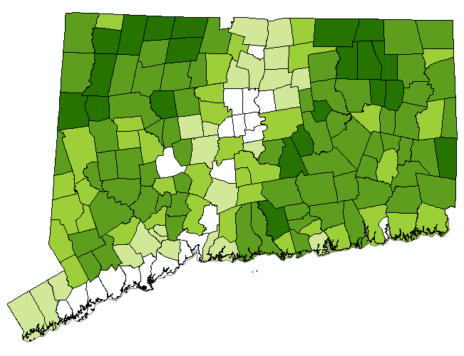 |
The area of each municipality was divided by the area of the Forest classes to determine the percent Forest. This map in intended to be used with the Percent Forest in 1985 map. |
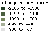
Change in Forest (acres) 1985 to 2006 |
|
 |
The area (in acres) of the Forest classes for each municipality in 1985 was compared to the area (in acres) of the Forest classes for each municipality in 2006. The municipalities are then colored based on the change, in acres, according to the legend (above). Note that there is a bias to the larger towns that have more acres. |
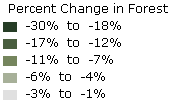
Percent Change in Forest 1985 to 2006 |
|
 |
|
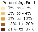
Percent Agricultural Field in 1985 |
|
 |
|
Percent Agricultural Field in 2006 |
|
 /> /> |
|
Change in Agricultural Field in (acres) 1985 to 2006 |
|
 |
|
Percent Change in Agricultural Field 1985 to 2006 |
|
 |
|
|
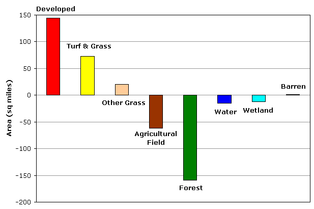
A bar graph showing land cover change in Connecticut between 1985 and 2006.
|
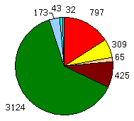
Pies |
|||||||||||||||
|
|||||||||||||||
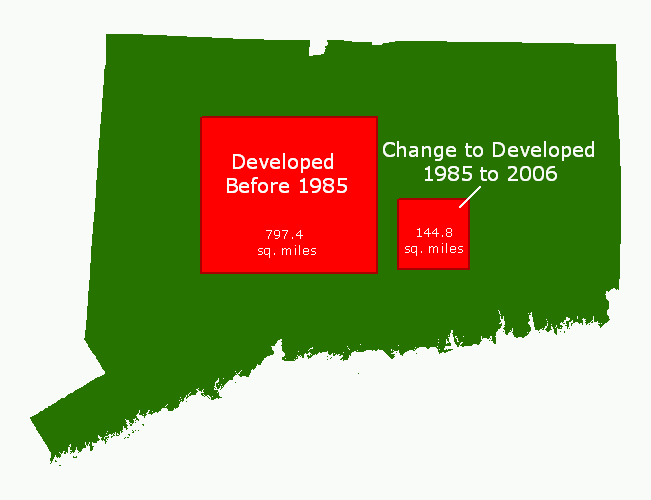 |
If all of the Developed land in Connecticut was clumped together in a square, it would cover the area shown. The smaller square represents all area that was changed to Developed between 1985 and 2006. |
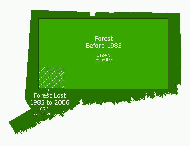 |
If all of the Forest land in Connecticut was clumped together in a square, it would cover the area shown. The smaller square with hatch marks represents the area that was converted from Forest to a different land cover between 1985 and 2006. |
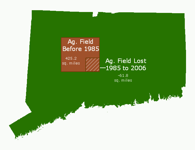 |
If all of the Agricultural Field land in Connecticut was clumped together in a square, it would cover the area shown. The smaller square with cross hatches represents all area that was converted from Agricultural Field to a different land cover between 1985 and 2006. |
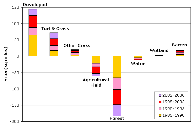 |
A bar graph showing land cover change. Each bar in the graph is colored based on time period. Note that the time periods do not all contain the same number of years. Developed, Turf and Grass, and Other Grass increased during the time 21-year time period while Agricultural Field and Forest classes decreased. |
Statewide Land Cover and Land Cover Change
1985 |
1990 |
1995 |
2002 |
2006 |
Change |
sq. miles | % of state | sq. miles | % of state | sq. miles | % of state | sq. miles | % of state | sq. miles | % of state | sq. miles | % of state |
| Developed | 797.4 | 16.0% | 862.3 | 17.4% | 885.5 | 17.8% | 922.8 | 18.6% | 942.1 | 19.0% | +144.8 | +2.9% |
| Turf & Grass | 308.9 | 6.2% | 325.9 | 6.6% | 341.7 | 6.9% | 362.5 | 7.3% | 381.7 | 7.7% | +72.8 | +1.5% |
| Other Grasses | 65.3 | 1.3% | 68.7 | 1.4% | 76.1 | 1.5% | 82.4 | 1.7% | 86.0 | 1.7% | +20.8 | +0.4% |
| Agricultural Field | 425.2 | 8.6% | 403.9 | 8.1% | 391.8 | 7.9% | 371.8 | 7.5% | 363.4 | 7.3% | -61.8 | -1.2% |
| Deciduous Forest | 2467.0 | 49.6% | 2410.5 | 48.5% | 2379.7 | 47.9% | 2338.2 | 47.1% | 2307.3 | 46.4% | -159.8 | -3.2% |
| Coniferous Forest | 455.9 | 9.2% | 452.4 | 9.1% | 449.5 | 9.0% | 445.2 | 9.0% | 441.1 | 8.9% | -14.8 | -0.3% |
| Water | 173.1 | 3.5% | 168.8 | 3.4% | 164.1 | 3.3% | 161.1 | 3.2% | 161.2 | 3.2% | -11.9 | -0.2% |
| Non-forested Wetland | 20.2 | 0.4% | 21.2 | 0.4% | 21.2 | 0.4% | 21.7 | 0.4% | 21.1 | 0.4% | +1.0 | 0.0% |
| Forested Wetland | 183.8 | 3.7% | 177.8 | 3.6% | 174.9 | 3.5% | 173.8 | 3.5% | 173.7 | 3.5% | -10.1 | -0.2% |
| Tidal Wetland | 22.6 | 0.5% | 22.9 | 0.5% | 23.0 | 0.5% | 23.2 | 0.5% | 22.9 | 0.5% | +0.3 | 0.0% |
| Barren | 32.1 | 0.6% | 37.3 | 0.8% | 44.4 | 0.9% | 49.1 | 1.0% | 51.4 | 1.0% | +19.2 | +0.4% |
| Utility (Forest) | 17.6 | 0.4% | 17.3 | 0.3% | 17.3 | 0.3% | 17.0 | 0.3% | 17.1 | 0.3% | -0.5 | 0.0% |