
College of Agriculture and Natural Resources
Center for Land Use Education and Research

This portion of the CLEAR Research site provides information on the results of our forest fragmentation analysis. By applying CLEAR’s forest fragmentation tool to the five remote sensing-derived land cover datasets of the Connecticut’s Changing Landscape study (1985, 1990, 1995, 2002, 2006), we can get a better sense of the health and function of one of our state’s most important natural resources.
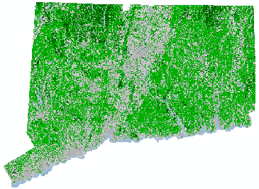
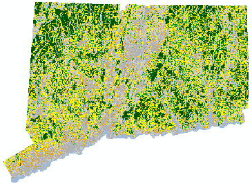
As shown in Connecticut’s Changing Landscape, about 60% of our state is classified as “forested,” i.e., covered with trees (green and dark green, below left). However, the quantity of the forest is not necessarily equal to the quality of the forest, which is greatly impacted by proximity to non-forested areas. Over the time period covered by our study, 1985 – 2006, the amount of “core” forest, which is relatively undisturbed by development, has decreased (green areas, below, right).
 |
 |
2006 forest cover where green is forest. |
2006 forest fragmentation where dark green is core forest and yellows and oranges are fragmented forest. |
