Looking for our list of upcoming webinars? Visit our Schedule page.
This web page serves as a repository for all CLEAR-related webinars. We will contiue to add links to webinars as they become available.
Check the CLEAR home page often for updates, or better yet, get on our emailing list to be sure to hear about new and upcoming webinars. We are always looking for new webinar ideas and welcome your suggestions. Send us an email at clear@uconn.edu, or use our comments form located on our Contact page.
Want to see more CLEAR-related videos? Check out our CLEAR Video Library.
May 4, 2022
Presented By Dave Wheeler, Stormwater Superintendent, South Burlington, VT
Run Time: 00:00:00
For the second webinar of our Stormwater Utility Series, the Stormwater Superintendent of South Burlington, VT, Dave Wheeler, will discuss the process of establishing the first stormwater utility in the state. This webinar will provide further detail on various aspects of setting up and maintaining a stormwater utility, such as the fee and schedule, use of funding, community impact, as well as what has been learned along the way.
December 8, 2021
Presented By Nefeli Bompoti & Marisa Chysochoou, TAB program, UConn Civil & Environmental Engineering
Run Time: 0:00:00
The webinar will provide an overview of the UConn TAB’s Technical Assistance program for activities supported in Spring 2022. UConn TAB is offering to provide assistance to New England municipalities at no cost for the Spring semester of 2022. The proposals will be supported through the University of Connecticut course Brownfield Redevelopment, which trains UConn students on all aspects of brownfields investigation, cleanup, and redevelopment. This webinar will outline examples of projects supported and details for submission.
November 17, 2021
Presented By Kristin Floberg & Charles Vidich, WestCOG
Run Time: 01:04:28
Following an explosion in scientific evidence pointing to the importance of riparian buffers as a means to reduce nonpoint source pollutants, on June 10, 2021 the Connecticut General Assembly enacted Public Act 21-29. This law expands the responsibility of zoning commissions in protecting the water quality of Long Island Sound to all 169 municipalities of the state. In expanding local authority – and responsibility – over coastal water quality, the law will require broader development and implementation of zoning strategies to control the discharge of a wide range of water pollutants – including “dead zone” causing nutrients such as nitrogen and phosphorus. This webinar will cover the history of past attempts to protect riparian corridors, the role riparian corridors play in reducing surface water pollution and hypoxia in Long Island Sound, review the range of riparian corridor protection strategies that have been adopted statewide, and provide model regulations for implementing Public Act 21-29.
July 1, 2021
Presented By Nefeli Bompoti & Marisa Chysochoou, TAB program, UConn Civil & Environmental Engineering
Run Time: 00:00:00
EJ SCREEN a mapping and screening tool developed by EPA to provide a nationally consistent data set and approach for combining environmental and demographic indicators. In this year’s EPA Brownfields Grant guidelines, it is suggested to utilize EJ SCREEN to help characterize target areas and identify threats to sensitive populations. In this webinar, the UConn Technical Assistance on Brownfields (TAB) team will provide a hands-on demonstration on how to use EJ SCREEN tool to develop your narrative proposal.
July 1, 2021
Presented By Dave Dickson and Amanada Ryan, UConn CLEAR and Extension
Run Time: 00:49:45
As we approach the 5th and final year of CT's updated MS4 permit we're offering a webinar to review the new tasks coming due, offer some guidance on what to expect next year, and address the most commonly confused MS4 concepts based on a review of Annual Reports. We'll also share some MS4 news and updates and check in on how communities feel their MS4 work is going.
June 16, 2021
Presented By Ashley Helton, Professor, UConn Dept. of Natural Resources and the Enviornment and the Center for Enviornmental Sciences and Engineering
Run Time: 00:43:47
Past land use activities (or land use “legacies”) can be strong indicators of contemporary water quality; yet watershed management strategies often neglect the lag times associated with land change trajectories. In this seminar, I will describe types of land use legacies in New England, present some evidence for the effects of land use legacies on water quality, and summarize upcoming research focused understanding on how land use history and intensity may influence water quality (with a focus on nitrogen) in streams and rivers of the Long Island Sound (LIS) watershed.
May 26, 2021
Presented By Kim Bradley, UConn Extension Trails Program Coordinator
Run Time: 00:58:52
The State of Connecticut has a vast number of open space and outdoor recreational opportunities, however information for trail users can be inconsistent, inaccurate, and difficult to find. The Connecticut Trail Finder, currently in development through UConn Extension, will be a free, interactive mapping website designed to help Connecticut residents and visitors explore trail and outdoor recreation opportunities, trailside services, and events across the state. Connecticut Trail Finder will compile trail manager approved trails with the goals of becoming the primary trails data source for the State of Connecticut and connecting users with trail management organizations and resources. This webinar will provide an overview of the resource to trail users, exploring the current and developing features of the website, and provide information for trail and land managers on how you can add your trail systems to the Connecticut Trail Finder. The Connecticut Trail Finder is funded through generous support from the Department of Energy and Environmental Protection and the Department of Transportation.
May 19, 2021
Presented By Nicole Friedenfelds and Amy Cabaniss, Natural Resources Conservation Academy (NRCA), Dept. of Natural Resources and the Environment
Run Time: 01:01:10
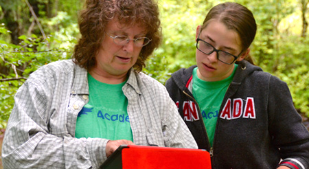
Have a great idea for a conservation project in your community or land trust, but not sure you have the staff power, technical know-how, or energy to carry it out? Wouldn't it be great to connect with local youth in that effort? Tune in to this webinar to learn how the UConn Natural Resources Conservation Academy (NRCA) is engaging high school students in wildlife monitoring, water quality, promoting pollinators, outdoor recreation, and other environmental projects in communities throughout Connecticut. NRCA faculty will share insights on ways to build capacity for your organization through youth engagement. Through this webinar, you'll learn about tangible projects that can help address local environmental needs and hear directly from teen and adult participants about their experiences in UConn NRCA programs and the community actions they carried out.
April 28, 2021
Presented by
Laura Brown, Community & Economic Development Educator, UConn Extension,
Courtney Hendricson, Vice President of Partnerships, AdvanceCT,
Kristen Gorski, Economic Development Coordinator, Town of West Hartford, and President, CT Economic Development Association (CEDAS)
Run Time: 00:41:33
Many communities struggle to find a comfortable balance between the desires of the business community, the desires of residents, and the requirements of existing zoning regulations and regulatory processes. In this session, the presenters will offer suggestions for finding this balance by exploring topics including: the role of economic development in the local land-use regulatory process; what companies are really looking for in a community; ensuring your community is ready for a desired development project; why and how to say no to a development proposal; and how to strike the right balance between zoning enforcement (which sometimes means saying no to business) while simultaneously encouraging the right kind of projects for your community. Attendees will learn about the Best Practices in Land Use and Economic Development Program, created by the Connecticut Economic Development Association and the Connecticut Chapter of the American Planning Association, and how to utilize the program as a tool for balancing economic development and planning.
April 21, 2021
Presented By Chet Arnold, UConn Extension & CLEAR and Qian Lei-Parent, UConn Extension & CLEAR
Run Time: 00:37:03
Land use planners, property owners, and watershed managers need all the help that they can get to reduce the impacts of nitrogen (N) pollution on waterways, particularly in coastal areas. CLEAR, URI and EPA have developed an online tool, N-Sink, that provides some of this help. N-Sink identifies areas within a watershed that are likely to contribute N to coastal waters, and other areas that are likely to remove N from the system before it gets to the coast. The tool now covers all of the coastal watersheds of Connecticut and Rhode Island. This 30-minute webinar will describe the workings behind the tool, demonstrate the new N-Sink web app, and initiate a discussion on ways that the information might be used.
March 24, 2021
Presented By Dave Dickson, UConn Extension and CLEAR
Run Time: 00:36:15
Nearly eight years ago, CLEAR’s NEMO program first launched an app to help homeowners, landscapers, developers, and municipalities properly site, size, install, and maintain a rain garden to help protect their water resources. The app has since expanded to include state-specific rain garden sizing and plant information for 25 states. Now, the app has received a new update that will allow it to work on ANY device with a web browser – PC, tablet, iPhone, or even an Android phone! This webinar will cover how the app works, how you can access it, and how you can use it for public outreach.
March 10, 2021 April 4, 2021 May 12, 2021 June 9, 2021
A four-part online speaker series about climate change and its effects on coastal forests in northeastern U.S.
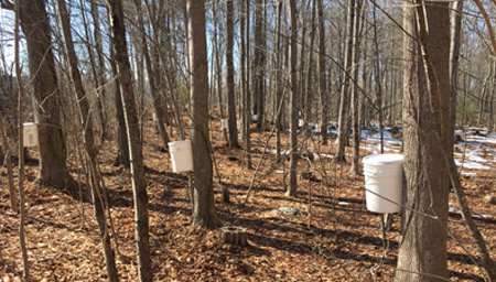
March 3, 2021
Presented By Tom Worthley, UConn Extension
Run Time: 00:58:00
As winter winds down, and you’re considering outdoor, low-risk activities, making a small batch of maple syrup at home with your family might be a fun and healthy choice. This webinar will provide all the essential information you’ll need to get started, from identifying which of your trees might be sugar maples, to tapping, boiling and finishing the sweet product for use on your favorite pancake recipe. Extension Forester Tom Worthley will take you through the process and share some tricks he has learned.
Contact Tom with questions at thomas.worthley@uconn.edu.
February 24, 2021
Presented By Emily Wilson, UConn Extension and CLEAR
Run Time: 00:40:00 (formal presentation), 1:08:59 (full recording)
Learn about how GIS is done in Connecticut, how we compare to our New England neighbors, and what might be done to make GIS operations more efficient and effective.
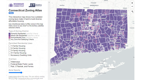
February 17, 2021
Presented By Sara Bronin, UConn Law School & Cary Chadwick, UConn CLEAR
Run Time: 00:32:18
In January, Desegregate CT, a coalition of over 60 organizations focused on land use and zoning reform, released its groundbreaking interactive map, the Connecticut Zoning Atlas. This first-in-the-nation planning tool allows the public to easily explore zoning regulations that govern housing in each of the state's 2,618 zoning districts and two subdivision districts without having to sift through and decode thousands of pages of written code. This webinar will focus on one particular aspect of the Zoning Atlas: the areas within a half-mile of train stations and CT fastrak stations. It will start with a broad overview of Desegregate CT and its platform as it relates to TOD, and it will show how you can use the Atlas to assess how your community already permits TOD. The webinar will conclude with some information about the Desegregate CT’s TOD proposals and how they have worked in other states, including neighboring Massachusetts.
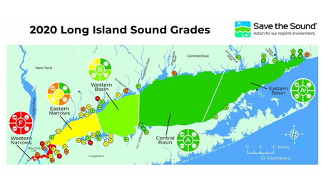
February 10, 2021
Presented By Peter Linderoth, Save the Sound
Run Time: 00:38:46
What is this map telling us? Join Peter Linderoth from Save the Sound as he discusses the latest release of the Long Island Sound Report Card. The Report Card grades the ecological health of the open waters of the Sound in addition to numerous embayments. Peter will present an overview of the water quality data sources, grading process, and then dive into the grades and general findings.
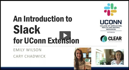
June 23, 2020
Presented By Cary Chadwick and Emily Wilson, UConn CLEAR
Run Time: 00:38:52
UConn Extension webinar on using SLACK for office communications.
June 16, 2020
Presented By Dave Dickson, UConn CLEAR
Run Time: 00:37:10
This webinar will provide an update on where towns and institutions should be under the deadlines out lined in the 2017 MS4 General Permit. It will also look ahead to the tasks to be addressed in year 4 of the permit cycle (ending June 30. 2021).
In response to the new work environment necessitated by the pandemic, CLEAR created a “Social Distancing” series of brief, 30 minute webinars. These webinars featured CLEAR faculty, other CAHNR faculty, and various project partners and covered a wide range of topics from covid-induced land use regulation changes to marsh migration to bobcat populations in Connecticut, and much more. The series was comprised of 20 webinars during the period between late March and the end of May, 2020.
December 12th, 2019
Presented By Chet Arnold, CLEAR Director and Emily Wilson, CLEAR Geospatial Extension Educator.
Run Time: 00:56:32
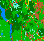
The Connecticut's Changing Landscape project now encompasses 7 dates covering the 30-year period from 1985 to 2015. What's been happening to our state's landscape over that period? This webinar will cover the basics of the "CCL" project and discuss the results, including findings on overall land cover change, riparian area change, forest fragmentation, land cover change over ag lands, and watershed impervious cover. We'll also give a demo and tour of the newly revamped CCL web page, which features interactive mapping and graphics.
December 5th, 2019
Presented by Laura Cisneros, Ph.D., Nicole Freidenfelds and Amy Cabaniss, Ph.D., UConn Extension Faculty members, NRCA
Run Time: 00:52:24
Have a great idea for a conservation project in your community or land trust, but not sure you have the staff power, technical know-how, or energy to carry it out? Wouldn't it be great to engage local youth in that effort? Tune in to this webinar to learn how UConn's Natural Resources Conservation Academy (NRCA) is engaging youth in impressive land management, water quality, environmental assessment, recreation, and other environmental projects in communities throughout Connecticut. NRCA Faculty will share insights into ways of capacity-building through youth engagement. Through this webinar, you will learn about:

November 14, 2019
Presented By Victor Benni, Town of East Lyme and Michael Dietz, UConn CLEAR
Run Time: 01:09:00
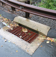
We'll highlight disconnection strategies from East Lyme and the UConn Storrs Campus. Vic Benni from East Lyme will share his method (and spreadsheet) for calculating total Directly Connected Impervious Area (DCIA) and describe some of the Low Impact Development (LID) installations they have used to get to the 2% disconnection goal. Then, Mike Dietz will cover how he tracks impervious cover at UConn and highlight some of the LID practices treating stormwater runoff in Storrs.
October 16, 2019
Presented By Emily Wilson, UConn CLEAR and David Kozak, CT DEEP
Run Time: 00:52:30
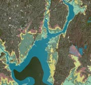
Sea Level Affecting Marsh Migration ( SLAMM) is a mathematical model developed by NOAA that uses digital elevation data and other information to simulate potential impacts of long-term sea level rise on wetlands and shorelines. CT DEEP recently completed a project to run the SLAMM model for the Connecticut coastline, to better understand how Connecticut's 21 largest coastal marshes and coastal area roads may respond to sea level rise (SLR). The model results have been turned into a new viewer on CT ECO.
October 1, 2019
Presented By Amanda Ryan, UConn CLEAR, David Dickson, UConn CLEAR, Joe Lanzafame, City of New London and Randy Collins, CT Conference of Municipalities (CCM)
Run Time: 01:03:52
Stormwater utilities are used across the country as a way for municipalities to cover the costs of installing and maintaining their stormwater infrastructure. The concept has been slow to catch on in Connecticut - the state's one and only utility was established in the City of New London just last year. Joe Lanzafame from New London will share how their utility came to be, how it's administered, and how it's going so far. We'll also hear an update from Randy Collins from the CT Conference of Municipalities (CCM) on the status of legislation to provide all CT municipalities with clear authority to establish their own stormwater utility.
June 24, 2019
Presented By Dave Dickson & Amanda Ryan, UConn CLEAR
Run Time: 00:54:21
The third year of the updated MS4 permit is about to begin and that means there are a few more tasks that towns will need to start tackling. This webinar will breeze through the permit tasks that recur each year, cover the new tasks due this year and provide an update on new tools and events to help towns with MS4 compliance.
May 29, 2019
Presented By Douglas Emmerthal, Program Leader CT-DEEP Forestry Division and Todd Bobowick, Resource Conservationist NRCS State Forester USDA-NRCS
Run Time: 00:57:59
Stress factors affecting oak trees in eastern CT including drought, defoliation due to gypsy moth caterpillars, and impacts of native opportunistic pathogens have caused the deaths of oak trees on tens of thousands of woodland acres in eastern Connecticut. In some places canopy loss is severe and in many the potential success of desirable regrowth is questionable. This webinar will explain the causes of the issue, describe the degree and extent of the problem and present several potential management scenarios. Information about opportunities for technical and possible financial assistance.
July 10, 2018
Presented by Adam Fox, P.E., Principal Engineer, Environmental Compliance, Contract Development & Permit Coordination Connecticut Department Of Transportation & Daniel Imig, P.E., Transportation Engineer 3, Environmental Compliance Section, Connecticut Department Of Transportation
Run Time: 00:32:48
CTDEEP recently released an MS4 permit for the Department of Transportation (DOT). While largely similar to the municipal version, there are some significant differences based on the DOT's different role.
This webinar will highlight the details of the DOT permit, how it differs from the municipal permit, how DOT plans to implement it, and how it overlaps with the work municipalities are required to do.
June 26, 2018
Presented By Dave Dickson & Amanda Ryan, UConn CLEAR
Run Time: 00:52:18
Connecticut's updated MS4 permit begins its second year on July 1st. Now that a year has passed, MS4 towns and institutions may be getting the hang of things but with a new year comes at least a few new tasks.
This webinar will cover the permit tasks that recur each year, highlight the new tasks due over the next year and provide an update on upcoming workshops and new tools.
June 19, 2018
Presented By Dr. Maria Chrysochoou Director of the Connecticut Brownfields Initiative (CBI) at the University of Connecticut & Ms. Binu Chandy, Deputy Director of the Office of Brownfield Remediation and Development at the Ct Department of Economic and Community Development (DECD)
Run Time: 00:54:21
Brownfields are underutilized properties, most often located in urban cores, the redevelopment of which is complicated by the potential presence of contamination. While Connecticut communities have made great strides in advancing brownfield revitalization, much work lies ahead and municipalities are often challenged by limited resources. In this webinar, Dr. Maria Chrysochoou Director of the Connecticut Brownfields Initiative (CBI) at the University of Connecticut and Ms. Binu Chandy, Deputy Director of the Office of Brownfield Remediation and Development at the Ct Department of Economic and Community Development (DECD), will discuss opportunities for brownfield redevelopment support. Specifically, Ms. Chandy will present an overview of brownfield financial assistance programs, while Dr. Chrysochoou will present the technical Municipal Assistance Program that is launched this year through CBI.
May 15, 2018
Presented By Dr. Mark A. Boyer, Board of Trustees Distinguished Professor, Geography, UConn, Executive Director, International Studies Association
Run Time: 00:45:10
Climate change is the signature issue of our time, yet the topic remains one of great controversy politically (if not scientifically). Mostly as a result of this political controversy, the global community has made little real progress toward developing a collective effort to grapple with climate change. Underlying this lack of progress is the enormous diversity in viewpoints about climate impacts. Many in the Global North focus on the impacts of recurrent severe weather patterns and the economic impacts they generate; others focus on the effects of sea-level rise and storm-water management in areas of relative wealth. In the Global South, however, impacts are much more humanly acute, as they create economic havoc, migration flows and extreme loss of agricultural productivity. Focusing on this diversity of global perspectives, this webinar will examine the nexus between climate change and security as it divergently impacts people around the globe. In the latter portion of the talk we will focus on the Caribbean and examine data on the threats to a range of island states.
April 24, 2018
Presented By James Hurd Research Associate, UConn, Dept. of NRE, Program Coordinator ConnecticutView and Chandi Witharana, Visiting Research Professor, UConn, Dept. of NRE, Director ConnecticutView
Run Time: 00:53:02
There is no shortage of available imagery to view the landscape of Connecticut, or any place in the world for that matter. Imagery comes in all types of spatial, spectral, radiometric and temporal resolutions, and each serves its purpose depending on the objectives of the person using it. The U.S. based Landsat series of multi-spectral satellite sensors has been collecting global imagery since 1972. A more recent satellite series, Sentinel-2, first launched in 2015 by the European Space Agency, is Landsat like and also provides global coverage. While these sensors may only provide moderate spatial resolution (10m – 60m) imagery, they are rich in spectral information, and together these satellites collect imagery over Connecticut at less than a seven-day interval. The best part, these data can be downloaded and used free. This webinar will briefly overview the Landsat and Sentinel-2 sensors, provide information about the images and how to download the data, and show examples of potential applications of this type of data in Connecticut using ArcGIS, along with some online resources for viewing the imagery.

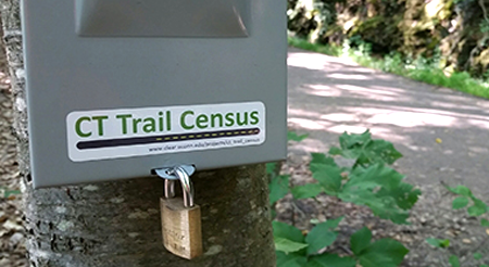
April 3, 2018
Presented By Kristina Kelly, Connecticut Trail Census Statewide Coordinator, Laura Brown, Community and Economic Development Educator with UConn Extension and Certified Economic Developer (CEcD), and Aaron Budris, Senior Regional Planner for the Naugatuck Valley Council of Governments
Run Time: 00:46:38
The Connecticut Trail Census is a statewide volunteer data collection program intended to inform a better understanding of multi-use trail use in the state of Connecticut and to make this important information available to trail user groups, administrators, government agencies and the general public. The Census collects 2 types of data: 1) Count data obtained by use of infrared (IR) counters installed at 15 sites on 11 different multi-use trails across the state, and 2) Survey data from a survey administered by volunteers at each trail site. The survey collects data regarding trail use topics such as distance traveled to use the trail, primary reason for using the trail, and demographic information about who is using the trail. The first full year of count and survey data has just been released and this webinar is being offered to walk through how to interpret the data and the exciting variety of applications the data could have.
March 20, 2018
Presented By Ted Diers from the NH Watershed Management Bureau & Mary McCarthy, Program Manager, Educational Outreach
Run Time: 00:56:21
The State of New Hampshire has developed a novel way to provide for effective snow management and removal while also reducing impacts of chlorides on the environment. The Green Snow Pro program provides training and certification in efficient and environmentally friendly winter maintenance practices for municipal, state, and private snow plow drivers. Certified Green Snow Pro Drivers receive liability protection.
This webinar will highlight how the program was developed, how it works, and what kind of impact it has had. There will also be some discussion of efforts to try to adapt the model to CT.

February 27, 2018
Presented By Lynn Stoddard and Jessica LeClair, Eastern Connecticut State University's Institute for Sustainable Energy
Run Time: 00:39:40
Join us to explore Sustainable CT, a new statewide, sustainability certification program for Connecticut's cities and towns. Lynn Stoddard and Jessica LeClair of Eastern Connecticut State University's Institute for Sustainable Energy will present an overview of the program and describe the certification process. Sustainability actions, policies, and investments deliver multiple benefits and help towns make efficient use of scarce resources and engage a wide cross section of residents and businesses. There are many ways to participate - join us to learn how you can be involved in Sustainable CT!
Janurary 30, 2018
Presented by Laura Cisneros & Abby Beissinger, NRCA, UConn Department of Natural Resources and Environment
Run Time: 00:51:32
Conservation groups that depend on the efforts of volunteers often find themselves with a long to-do list to achieve their conservation goals. At the same time, these organizations often seek to include youth in their efforts, but may find it difficult to know where to start. By engaging youth, these organizations not only can expand their capacity to impact the local environment, but also help train the next generation of conservation leaders and informed citizens.
UConn's Natural Resources Conservation Academy (NRCA) programs train teens, adult volunteers and teachers in natural resource science to catalyze on-the-ground conservation projects through a mentorship model. The NRCA has collaborated statewide with 90 conservation partners to mentor 136 service-learning projects that have generated real conservation benefits to Connecticut communities.
In this webinar, NRCA Coordinators Abby Beissinger and Laura Cisneros will: 1. Describe best practices for effectively mentoring while accomplishing conservation goals; and 2. Provide examples of effective mentoring that has led to the success of many NRCA projects.
October 24, 2017
Presented By Dave Dickson & Cary Chadwick, UConn CLEAR
Run Time: 01:05:54
This webinar is part II of a two-part webinar focused on nitrogen pollution in Long Island Sound. This session will highlight CT DEEP's secondary generation strategy for addressing the sources of nitrogen pollution. The webinar will cover progress made to date in addressing Nitrogen as well as the steps DEEP is taking moving forward. The strategy includes new approaches for wastewater treatment, regulatory and non-regulatory approaches to stormwater management and various sources of nitrogen, and a focus on coastal embayments.
June 28, 2017
Presented By Kelly Streich, CT DEEP
Run Time: 00:45:53
This webinar is part II of a two-part webinar focused on nitrogen pollution in Long Island Sound. This session will highlight CT DEEP's secondary generation strategy for addressing the sources of nitrogen pollution. The webinar will cover progress made to date in addressing Nitrogen as well as the steps DEEP is taking moving forward. The strategy includes new approaches for wastewater treatment, regulatory and non-regulatory approaches to stormwater management and various sources of nitrogen, and a focus on coastal embayments.
June 27, 2017
Presented By Dave Dickson & Amanda Ryan, UConn CLEAR
Run Time: 01:07:41
Connecticut's new MS4 permit becomes effective on July 1. You have completed your new Stormwater Management Plan and successfully completed your registration form, but now what? Where do you start? This webinar will highlight what you should begin working in the first year of the new permit and provide tools, examples, and approaches to help.
June 14, 2017
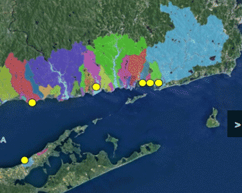
Presented By Jamie Vaudrey, UConn Marine Sciences
Run Time: 01:01:12
This webinar will highlight the folks of UConn Professor Dr. Jamie Vaudrey's research into the sources of nitrogen pollution in Long Island Sound embayments. The results of her study are very useful in determining the greatest contributors of nitrogen to each of the coastal embayments along the sound. Armed with the knowledge towns and the state can make decisions about how best to focus nitrogen pollution reduction efforts.
June 1, 2017
Presented By Emily Wilson, Geospatial Educator, UConn CLEAR
Run Time: 00:48:00
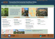
Connecticut Environmental Conditions Online or CTECO is the state's home to natural resource based geospatial data. The website has been revamped with a new look and new viewers to make the data easier to find and use for everyone from the casual user to the geospatial wizard. It is also the home to the State's new (2016) high resolution (3 inch) imagery.
This webinar will highlight the new features of the site and how to navigate it.
May 2, 2017
Presented By Juliana Barrett, Associate Extension Educator, UConn CLEAR & Bruce Hyde, Land Use Academy Director, UConn CLEAR
Run Time: 00:50:57
This webinar will provide answers to a number of the questions raised at Legal Issues in the Age of Climate Adaptation, a conference held by UConn CLEAR and and Connecticut Sea Grant’s Climate Adaptation Academy in late 2015. The questions, which came from the audience members during the course of a panel discussion with prominent land use attorneys, were reviewed by the Marine Affairs Institute & RI Sea Grant Legal Program at Roger Williams University School of Law. The Legal Program then developed four fact sheets covering the following topics: Property and Permitting Boundaries at the Shoreline, Governmental Tort Liability for Disclosure of Flood Hazard Information, Takings and Coastal Management, and Flood and Erosion Control Structures. The CLEAR/Connecticut Sea Grant climate team will be joined by two attorneys to go over the answers and discuss the issues raised in these fact sheets, including a review of recent court decisions impacting these topics.
February 14, 2017
Presented By Mike Dietz, UConn CLEAR & Lukas McNaboe, UConn Grad Student
Run Time: 00:50:07
Road salt use continues to increase in cold regions of North America. State Departments of Transportation and Municipal Public Works managers need to provide safe travel conditions for the public, however all of the salt applied to our roads ends up in local surface or groundwater, where it can impact aquatic organisms and contaminate drinking water supplies. This webinar will cover current trends in salt use for deicing, and salt levels in ground and surface waters of the Northeast. Impacts to aquatic life will be discussed. Research at the University of Connecticut on deicing impacts to groundwater and surface water will also be highlighted.

February 7, 2017
Presented By David Dickson & Amanda Ryan, UConn CLEAR
Run Time: 01:15:22
For the 121 communities (plus institutions) covered under CT DEEP's newly revised "MS4" stormwater regulations, the first requirements are to develop (or revise) a Stormwater Management Plan (SWMP) for your town and register as an MS4. Draft SWMPs are to be posted for public comment and submitted to CT DEEP by April 1, 2017. Yikes! This presentation will cover what's required to be in the plan, share a template for a SWM Plan that you can adapt and use, and introduce you to NEMO's new MS4 Online Guide which be a repository for tools, maps and information related to the permit.
November 9, 2016
Presented By Dr. Gary Robbins, Dept of Natural Resources & the Environment, University of Connecticut
Run Time: 00:57:27
Connecticut has an abundance of good quality groundwater owing to its geologic past. In this webinar, Dr. Gary Robbins, Hydrogeologist at UCONN, will discuss our groundwater resources—where they are, how much we might have and use, their importance to the health of our environment, and what we need to do to sustain and protect them. He will also discuss issues concerning the use of our groundwater resources to help our faulting economy.
Have questions regarding your own well?—The doctor will be in.
October 11, 2016
Presented By David Dickson & Chet Arnold, UConn CLEAR
Run Time: 01:23:43
The State of Connecticut has committed to an expanded stormwater regulatory program for municipalities, and CLEAR's NEMO Program will be providing outreach and assistance to towns and institutions to support them in complying with this program.
This introductory webinar will provide an overview of the new requirements in this permit and how the NEMO program is planning to support communities in meeting those requirements.
May 31, 2016
Presented By Tom Worthley, Project Manager UConn CLEAR, UConn and Jeff Ward, Department of Forestry and Horticulture, The Connecticut Agricultural Experiment Station
Abstract
Aligned with the theme of Connecticut's Changing Landscape, but looking much farther back in time, we will discuss the natural forces and human land-use activities that have shaped the composition and structure of the forest resource in CT as we see it today. Historical narratives and images, along with some data and discussion of current trends can be anticipated.
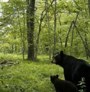
May 5, 2016
Presented By Cary Chadwick, UConn CLEAR & Michael Evans, Graduate Student, Departement of Natural Resources and the Environment
Run Time: 01:03:56
If you've been following the news for the past few years, you know that black bears have returned to Connecticut. Given this fact, it is important to understand how these animals respond to different levels of developed landscapes. In order to evaluate the factors that govern bear activity, resource use, and movement across the landscape, UConn grad student Mike Evans has conducted research on three facets of bear ecology - population density, dispersal patterns, and resource selection. Mike and his colleagues at the Connecticut Department of Energy and Environmental Protection’s Wildlife Division have produced the first robust estimate of the size and distribution of Connecticut’s black bear population. This webinar will present these findings and provide perspective on how such information can be used to inform proactive bear management and predict future interaction between bear and human populations. It will conclude with a tour of the new interactive online Story Map that enables the user to explore some of the bear data on their own.
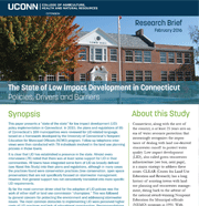
April 5, 2016
Presented By David Dickson & Chet Arnold, UConn CLEAR
Run Time: 00:53:39
The concept of low impact development (LID) has been around for quite some time now. So....is Connecticut buying it? If so, how much? If not, why not? New research by CLEAR's NEMO Program provides some answers to these questions. This webinar will review the results of our extensive internet research covering 85 towns, and accompanying phone interviews with 78 people in those towns involved in the land use process. What are the top 5 drivers that help bring LID to a community? The top 5 barriers that keep it out? What do town planners think needs to be done? You can get the report or visit the Story Map, but why not drop by the webinar too?
March 10, 2016
Presented in partnership with CIRCA, the CT Institute for Resilience and Climate Adaptation
Run Time: 00:57:33
An increasing awareness of the need to reduce the potential adverse impacts of hardened coastal structures has prompted interest in the development of living shorelines as an alternative. This webinar will review of the benefits of living shorelines in comparison with traditional hardened shoreline protection structures, including non-structural and hybrid approaches, and describe the effectiveness of these approaches in response to waves, storms and sea-level rise. The webinar will also explore where living shorelines may be suitable on the Connecticut Coast based on an automated geospatial model which determines the suitability of living shoreline treatment options for the Long Island Sound shoreline. Factors such as fetch, bathymetry, erosion rates, marsh, and beach are taken into consideration in producing site suitability. This presentation will provide a brief overview of the site suitability model, as well as a tutorial of an online map-viewer which has been developed to display results from the analysis. A brief overview of the conference proceedings from the first-ever national living shorelines summit in Hartford, which drew nearly 300 researchers, government employees, engineers, students and others, will be provided.
December 8, 2015
Presented by Tom Worthley, UConn CLEAR, and Jeffrey Ward, CT Agricultural Experiment Station
Run Time: 00:59:32
This webinar will highlight the forest stand conditions along roadsides that contribute to the tree issues we encounter during high-intensity wind-storm events. It will also explore how traditional arboriculture and silviculture by themselves have not adequately addressed the management issue. A new approach will be introduced that blends the two scopes of practice and can be applied to protect the roadside forests we all love while growing and maintaining them in a healthier way. The webinar will end with a discussion of all the stakeholder groups that must be involved to operationalize the approach across the landscape.
November 2, 2015
Presented by Dan Civco, Professor, Department of NRE, UConn Director, Center for Land Use Education And Research (CLEAR) and James Hurd, Research Associate, Department of NRE, UConn Director, Laboratory for Earth Resources Information Systems (LERIS)
Run Time: 00:52:16
Landsat represents the world's longest continuously acquired collection of space-based moderate-resolution land remote sensing data. First launched in 1972, for over four decades Landsat has provided a unique resource for those who work in water resources, agriculture, geology, forestry, regional planning, education, mapping, and global change research. Landsat images are also invaluable for emergency response and disaster relief. This webinar will provide a basic overview of the Landsat satellite and imaging sensors, where and how to acquire the freely available data, how to prepare Landsat data for use in ArcGIS, and how to calculate some derivative information.

September 21, 2015
Presented by Alyssa Norwood, Connecticut's Legislative Commission on Aging
Run Time: 00:52:16
This webinar was recorded on September 21, 2015. Alyssa Norwood from Connecticut's Legislative Commission on Aging provides statistics on the state's ageing populations and how to address it from a land use planning perspective. Moderated by UConn CLEAR's Bruce Hyde.
July 28, 2015
Presented by Dan Civco, Professor, Department of NRE, UConn Director, Center for Land Use Education And Research (CLEAR) and James Hurd, Research Associate, Department of NRE, UConn Director, Laboratory for Earth Resources Information Systems (LERIS)
Run Time: 00:50:39
We have all seen remotely sensed imagery, and many of us use imagery as a background layer to our GIS maps and to derive spatial information. But, how many of us really understand the process of how that image was collected and what it is showing us, or could show us? Furthermore, how many of us are aware of the wide variety of imagery that is available and how to access and use these images? This webinar will provide a basic overview of the remote sensing process and describe what we are really seeing in an image and how it is collected, describe various types of imagery that are available and where they can be obtained, and present some basic interpretation techniques to derive spatial information from the imagery.
June 16, 2015
Presented by Mark Boyer, Board of Trustees Distinguished Professor, Political Science, UConn and Melanie Meinzer, Graduate Student, UConn
Run Time: 00:49:26
When confronted with the demands of global climate change, why do some towns move the climate adaptation agenda forward in their communities while others seemingly get little accomplished? To answer this question, we look at the “big picture” of what’s going on across Connecticut on climate adaptation. We’ll first look at what is driving public policy based on past research, thus briefly discussing competing and complementary explanations for why some communities aggressively pursue climate adaptation policies, while others do less. We then dig into our data collected across the 169 towns in Connecticut regarding climate adaptation, linking policy actions to their fundamental global cause. The quantitative data is augmented with interview data from policy-makers and activists from around the New England region.
April 21, 2015
Presented by Cary Chadwick, UConn CLEAR and Tessa Getchis, UConn Aquaculture, Shellfish Management
Run Time: 00:49:39
Shellfish aquaculture is a large and growing part of Connecticut's agriculture sector but site selection is a major challenge. Farmers cultivate oysters, clams and scallops in designated areas of Long Island Sound. Those sites are considered public property and are leased from the state. Because these underwater farms are not located on private property, new or expanding activities are faced with a significant amount of scrutiny. Farmers need to identify growing areas that are biologically productive for their crop while also considering the potential use conflicts or environmental interactions with their activity on those sites. To help improve site selection for aquaculture, the Aquaculture Mapping Atlas was developed in partnership between the UConn CLEAR, Connecticut Sea Grant and the Connecticut Department of Agriculture. This tool provides users with access to relevant aquaculture, navigation and natural resource data layers and information. This webinar will introduce the new function and capabilities of Version 4. View Webinar as pdf
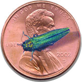
February 10, 2015
Presented by Nancy Marek, UConn Extension Forestry and Chris Donnelly, CT DEEP Urban Forestry Coordinator
Run Time: 01:07:58
The emerald ash borer is a small, shimmering green, non-native insect that kills ash trees. Learn about the biology of the pest, how to identify an ash tree, what efforts are currently being used to control and manage the insect, and what steps private landowners and natural resources professionals can take to limit the impact of the infestation. View Webinar as pdf
March 17, 2015
Presented by John Volin & Laura Cisneros, UConn Department of Natural Resources and Environment, College of Agriculture, Health and Natural Resources
Run Time: 00:50:55
UConn's Natural Resources Conservation Academy (NRCA) is a new transformative program that engages high school students in land use and natural resource conservation in an exciting and meaningful way for the student that is beneficial to our communities and environment. Each year ~24 students participate in a week-long field experience at UConn, where they learn from UConn faculty and students as well as other environmental professionals about the natural world in a land use context. Afterwards, the students apply their skills during a seven-month conservation-focused project addressing local environmental issues in their own community under the mentorship of a community partner (e.g. local planners, decision-makers, scientists, environmental professionals on land trusts and conservation/wetland commissions). To date, 53 community projects have been completed or are currently being conducted throughout Connecticut by our NRCA students. These projects have proven to be not only beneficial to the students but to their community partners and communities. During this webinar, we will provide a brief background on the NRCA and discuss examples of NRCA projects conducted throughout the state, successful community partnerships, and the potential benefits of partnering with the NRCA. View Webinar as pdf
October 28, 2014
Presented by Cary Chadwick and Emily Wilson, UConn CLEAR
Run Time: 00:37:23
Lidar is a detection system that uses light from a laser on an airplane to collect very accurate and dense elevation values with many different applications (and it looks really cool!). Connecticut is (partially) covered by a patchwork of Lidar datasets captured at different times by different companies with different specs. Most of the data sets are now available on the Connecticut Environmental Conditions Online (CT ECO) website in an interactive format (that means you can zoom in). This webinar will highlight what is available including elevation, hillshade, shaded relief, slope and aspect and how to access it. It will briefly discuss what is happening under the hood to get volumes of data out to you over the internet and will also discuss the missing areas of the state. CT ECO is a website that was designed to provide access Connecticut’s natural resource data layers. It is a partnership between the UConn CLEAR and CT DEEP. View Webinar as pdf
September 23, 2014
Presented by Linda Powers Tomasso, Project Associate, Center for Health and the Global Environment, Harvard University School of Public Health, and Emily Wilson, UConn CLEAR
Run Time: 00:53:04
Greenhouse inventories (GHG) estimate levels of emissions which are scientifically understood as the human-induced basis for climate change. GHG inventories ideally resemble balance sheets indicating both emissions sources and carbon “sinks” that remove atmospheric CO2 via long-term carbon storage in vegetation cover, soils, and forests. Like all New England states, Connecticut over the past decades has seen a loss of its beneficial carbon sinks due to land converted from forested and vegetated landscape to areas of sprawling regional development, to the detriment of state efforts to combat climate change. To date, carbon sinks have been omitted from GHG inventories due to insufficient accounting methods, leading policy-makers to undervalue Connecticut’s forests and open spaces as agents of regional climate stabilization.
Linda Powers Tomasso explored the problem of carbon sink accounting in her graduate thesis research using CLEAR’s twenty-five years of satellite monitored land use data. In this webinar, Linda will walk us through her research findings, explaining state land cover change and its relation to the loss of carbon storage and sequestration which help keep emissions rises in check. Her accounting methods propose a new use for CLEAR land cover data, with surprisingly robust results, leaving us with the question: should forest conservation garner greater attention and public funding as a cost effective mitigator against climate change? View Webinar as pdf
July 23, 2014
Presented by Mark Rudnicki, UConn Associate Professor, Forest Ecology, Department of Natural Resources and the Environment
Run Time: 00:58:18
Connecticut is a state with magnificent and plentiful forest cover, but we have a continuing problem with trees causing power outages. The STORMWISE initiative, developed at the University of Connecticut, seeks to integrate outreach, education, research and economic feasibility to provide practicable solutions to mitigate tree-related power outages.
This webinar will show how trees acclimate to wind forces and how this knowledge is being used to design solutions to enhance tree strength along power line (distribution) corridors in Connecticut. We will also discuss how these forest management solutions can also promote local wood production and use in everything from flooring and cabinets to biofuel or firewood.
This webinar will also highlight the ongoing efforts in education/outreach to gain public acceptance and adoption of Stormwise practices. This effort is closely aligned with social science research to better understand attitudes and perceptions regarding trees and their management for increased power resilience.
May 13, 2014
Presented by Michael Dietz & Chet Arnold, UConn CLEAR
Run Time: 01:41:01
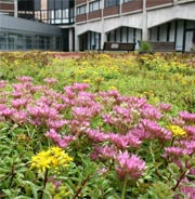
The main campus of the University of Connecticut is rapidly becoming a showcase for the innovative stormwater practices known as green infrastructure (GI), or low impact development (LID). Green roofs, rain gardens, pervious parking lots and walkways, bioretention cells, and other GI features now dot the campus landscape. This webinar will show what they look like, discuss how are they working, and explore whether there are lessons to be learned. We will:
April 1, 2014
Presented by Joel Stocker, UConn CLEAR & Sea Grant and Kevin O'Brien, CT DEEP
Run Time: 00:57:25
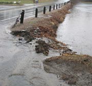
Recent storms have focused interest on the dynamics of the shoreline. Receiving attention is the question, “What has it done in the past?” In 2010 the USGS released a report on historical shoreline change along the New England and Mid-Atlantic coasts from Virginia to Maine. Connecticut, behind Long Island and Long Island Sound, was not analyzed. With funding from NOAA and National Sea Grant, our team from Connecticut Sea Grant, UConn Extension, and Connecticut Department of Energy and Environmental Protection has taken on an ambitious project designed to fill the gap. Our goal is to highlight and quantify the changes to Connecticut’s shoreline over the last 100 years. Using maps dating from the 1880’s, more recent GIS datasets, and a USGS software program shoreline features were analyzed along the entire length of the State using geologic and political boundaries. Results identify areas of change (both eroding and accreting), by quantifying not only how much the shoreline has moved, but also the rate of change. A summary of overall trends is also provided.

December 17, 2013
Presented by Cary Chadwick and David Dickson, UConn CLEAR
Run Time: 01:03:39
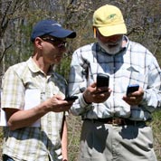
A simple search for "GPS" apps in the Apple App store or on Google Play will return thousands of results for free or low cost mapping apps now available on your smartphone. So where do you start? This webinar will start to answer that question. UConn CLEAR has been conducting GPS trainings for nearly a decade that have focused on using a handheld GPS unit to collect geospatial data in the field and then map it. Due to popular demand, we are developing a version of the course focused on using smartphones to collect field data instead of a dedicated GPS receiver. This webinar will provide an overview of the smartphone GPS universe and showcase our favorite apps for field data collection.
November 7, 2013
Presented by Juliana Barrett, CT Sea Grant & Joel Stocker, UConn CLEAR
Run Time: 00:40:57
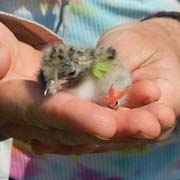
Great Gull Island, owned by the American Museum of Natural History (AMNH), has two species of terns nesting on the island: the Common Tern (Sterna hirundo) with 9,500 pairs and the Roseate Tern (S. dougallii) with 1,300 pairs. This represents the largest concentration of nesting Common Terns in the world, and the largest concentration of nesting Roseate Terns in the Western Hemisphere. Great Gull Island, 17 acres in size, is the site of a former army fort with crumbling battlements and boulders surrounding the edges of the island. The Common Terns use the interior island, while the Roseate Terns nest in the boulders. Vegetation, including many invasive plant species, has overtaken parts of the island causing loss of nesting habitat. Connecticut Sea Grant, CLEAR, and USFWS are working with the AMNH to develop and implement a habitat management plan for this island. This webinar will describe the fascinating history of Great Gull Island and our management efforts to improve tern nesting habitat.
February 20, 2013
Presented by David Dickson & Michael Dietz, UConn CLEAR
Run Time: 00:47:39
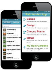
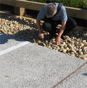
Rain gardens are depressions in the ground that collect and soak up stormwater runoff from roads, roofs, driveways, and other hard surfaces. They are relatively simple to install, are beautiful additions to the landscape, and help prevent water pollution. And now NEMO has made it even easier to install a rain garden of your very own with a new website and the nation's first Rain Garden smartphone app.
The app and website are aimed at homeowners, landscape professionals, municipal staff, or others who are interested in properly installing one or more rain gardens. This webinar will provide a live demonstration of the dynamic features of the app, which include a searchable plant database and tools that help site, size and install your rain garden properly. It will also highlight the features of NEMO & Connecticut Fund for the Environment's new Rain Garden website for those without a smartphone.
![]()
December 4, 2012
Presented by Emily Wilson and Chet Arnold, UConn CLEAR
Run Time: 00:50:48
How has our local landscape been changing over the last 25 years?CLEAR’s Changing Landscape is an ongoing project that uses remote sensing technology to chart land cover changes over time. Long Island Sound Study funding has allowed CLEAR to expand the project study area to include the portions of New York draining to the Sound, and to add a 2010 dataset that makes the total study period a whopping 25 years. Land cover change, riparian (streamside) zone change, and impervious area are all included in the study, and the information is posted on an extensive interactive website that includes data summaries and maps at the regional, state, major watershed, and small watershed levels. This webinar will introduce you to the study, go over a few basic findings, and give you a virtual tour of the site so that you can dig into the data, maps, and tables on your own. Whether you’re new to CLEAR land cover data or have been impatiently waiting for the update, this webinar is for you!
September 18, 2012
Presented by Bruce Hyde, UConn CLEAR and Juliana Barrett, CT Sea Grant
Run Time: 00:56:42
Hurricane Irene showed just how vulnerable we are to damage from storms and tidal inundation. The impact of climate change on coastal municipalities is likely to result in heavier downpours, more vulnerable coastlines, and increases to the amount of land that could be inundated by rising sea levels. These events will challenge communities to come up with adaptation strategies to address impacts that range from a loss of coastal wetlands to a loss of tax base.
This webinar identifies municipal issues related to climate change such as eroding coastlines, overburdened stormwater systems, failing septic systems, and street flooding, and provides examples of how some communities are addressing the challenge.
July 10, 2012
Presented by Jiff Martin, UConn Cooperative Extension and Adam Rabinowitz, UConn CANR
Run Time: 00:54:03
Most residents in Connecticut have consistent, dependable access to enough food for active, healthy living. Yet each year there are households that experience limited access to food due to a lack of money or other resources. Between 2008 and 2010, 12.7 percent of residents in Connecticut were living in food insecure households (38% of which were living in 'households with very low food insecurity'). Although it is extremely difficult to pinpoint where these food insecure households are located, we can look at certain town-level variables to draw comparisons on a town by town basis.
UConn Zwick Center for Food and Resource Policy, UConn Cooperative Extension, CT Food Policy Council, and UConn CLEAR have collaborated to develop the new Community Food Security (CFS) in Connecticut Study with an accompanying website with interative map features. The CFS study and website provides a picture of how towns in Connecticut compare to each other under three separate conditions: 1) What is the likelihood that a resident is at-risk for food insecurity?; 2) What is the status of access to food options and geographic proximity to food retailers?; 3) How well are town residents being served through public food assistance services?
July 18, 2012
Presented by Emily Wilson, UConn CLEAR
Run Time: 01:08:46
Interactive web maps are powerful tools for organizing and disseminating information for public consumption. For years, Google has led this revolution in online mapping by making it easy for practically anyone to create a custom web map of their own using Google Maps and Google Earth. ESRI, the creator of the most popular desktop GIS software, has recently launched ArcGIS.com, a free web based tool for creating web maps and mapping applications. It allows a user to create customizable maps with built in functions including the ability to: connect to a wide variety of base maps and mapping services, import existing GIS data, customize how information is displayed, edit data using a simple interface or smartphone, collaborate with others, create online galleries of web maps, establish public or private map groups, add new data, and more. This webinar will provide an overview of ESRI's new ArcGIS.com website and live demonstration of many of the functions listed above.
May 8, 2012
Presented by Cary Chadwick and Emily Wilson, UConn CLEAR
Run Time: 01:04:45
Interactive web maps are powerful tools for organizing and disseminating information for public consumption. For years, Google has led this revolution in online mapping by making it easy for practically anyone (even you) to create a custom web map of their own using Google Maps and Google Earth. But Google isn’t the only game in town anymore.
ESRI, the creator of the most popular desktop GIS software, has recently launched ArcGIS.com, a free web based tool for creating web maps and mapping applications. It allows a user to create customizable maps with built in functions including the ability to: connect to a wide variety of base maps and mapping services, import existing GIS data, customize how information is displayed, edit data using a simple interface or smartphone, collaborate with others, create online galleries of web maps, establish public or private map groups, add new data, and more. This webinar will provide an overview of ESRI’s new ArcGIS.com website. Many of the functions listed above will be covered through discussion and live demonstration and will include examples of how towns and land trusts might use the technology to meet their online mapping needs.
March 13, 2012
Presented by Michael Dietz and David Dickson, UConn CLEAR
Run Time: 00:49:51
No need to get on the bus for this tour! Join us for a virtual tour of Low Impact Development (LID) around the State of Connecticut. Dave Dickson and Mike Dietz will use NEMO's LID Atlas, a cutting-edge web tool powered by Google Maps, to highlight LID projects around the state. At each stop you'll learn the background of each site, get to see pictures, learn about obstacles, and successes. Different types of LID practices will be covered, from rain gardens to porous pavements. At the end, we'll demonstrate the use of the Atlas so that you can your own tour not only around Connecticut but the entire U.S. Perhaps some of these sites will inspire you to initiate an LID project in your town? Come find out!
February 28, 2012
Presented by Bruce Hyde, Emily Wilson and Chet Arnold, UConn CLEAR
Run Time: 00:50:53
A "buildout" analysis is a planning tool that can provide insight into the possible future impacts of a town's current land use regulations. But what does a buildout really tell you? In the first half of the webinar, we'll explain what a buildout is and isn't, go over common misconceptions about buildouts, and review several different types of buildouts and what type of data are needed for each. In the second half we'll illustrate some of these concepts with two case studies - one done in 2008 for the CT Office of Policy and Management and in partnership with the Central Naugatuck Valley Council of Governments, and a recently completed buildout done in partnership with the Town of Kent. And of course, we'll (attempt to) answer your questions. After spending this hour with us, you may not be able to do a buildout using your iPhone and a pocket calculator, but you will be able to ask good questions about the need for, uses, and types of buildouts that might apply to your community.
November 8, 2011
Presented by Emily Wilson and Chet Arnold, UConn CLEAR
Eligible for 1 CM credit.
Run Time: 00:48:49
Local land trusts and conservation commissions are major players in land conservation in Connecticut, yet few have direct access to technical resources that can help them in their task of permanently protecting open space. In many cases, web-based information and tools created by the UConn Center for Land Use Education and Research (CLEAR) can help. This presentation will use live online demonstration of these tools to show how they can be used to help make the case for, analyze and prioritize open space. The "tour" will include examples using the Connecticut's Changing Landscape website, online Community Resource Inventory, CT-ECO online mapping site, and GoogleEarth (which CLEAR, alas, did not create).
October 18, 2011
Presented by Joan Nichols, Government Relations Specialist, Connecticut Farm Bureau Association
Eligible for 1 CM credit.
Run Time: 00:53:17
According to a 2010 UCONN study, in 2007 Connecticut agriculture contributed $3.5 billion dollars to the state's economy and 20,000 jobs statewide. Agriculture is growing and diversifying in Connecticut to meet the demand for locally grown food and farm products. Agriculture is a unique land use that often does not fit into the mold of most land use regulations. It is important that municipalities understand the unique characteristics of agriculture so that regulations are written that allow for sustainability of local agriculture. This one hour webinar will highlight key points community leaders and planners should consider when drafting "farm-friendly" regulations and what steps communities should take to insure that the needs of the farming and non-farming community are addressed.
September 13, 2011
Presented by Michael Dietz, UConn CLEAR
Run Time: 00:56:15
Pervious pavements are recommended as an alternative to traditional asphalt or concrete pavements to reduce stormwater impacts. This webinar will discuss some different types of pervious pavements that are currently available, including pervious concrete, pervious asphalt, pervious interlocking concrete pavers (PICPs), and plastic grid pavements. Performance data, advantages/disadvantages for different applications, and some cost information will be discussed.
July 19, 2011
Presented by Cary Chadwick and David Dickson, UConn CLEAR
Eligible for 1 CM credit.
Run Time: 00:55:30
In today’s high tech world, it’s hard to go anywhere without seeing how the Global Positioning System (GPS) influences our daily activities. GPS technology is built into many new products, from smartphones to smart shoes. This webinar will introduce you to the magic behind the Global Positioning System and will discuss topics including how to choose a GPS unit to meet your needs, how to collect and display GPS data on a map and how to link photographs to a geographic location. This webinar will also discuss new trends in smartphone technology and methods for mapping field points using an iPhone or iPad.
June 22, 2011
Presented by Bruce Hyde, UConn CLEAR and Dudley (Skip) Alleman, Senior Project Manager
HRP Associates, Inc
Eligible for 1 CM credit.
Run Time: 00:52:48
Is that old gas station, dry cleaners or auto body shop in your town a Brownfield? Is a Brownfield an agricultural field in the winter or one that’s contaminated? It might be both. Brownfields come in all sizes and can be found in most communities, urban and rural. This presentation will focus on the Brownfield basics: types of Brownfields commonly found in communities, what it takes to clean them up, who’s responsible and who’s available to help. The impacts of Brownfields on the community and the environment will also be discussed.
May 10, 2011
Presented by Cary Chadwick and Emily Wilson, UConn CLEAR
Eligible for 1 CM credit.
Run Time: 01:01:50
A mapping “mashup” is a web application that combines data from different sources into a single integrated, online mapping tool. With the rise in online mapping technology from leaders like Google Maps and Google Earth, creating these mashup applications has never been easier. This one-hour webinar will demonstrate how anyone can use Google tools to publish basic geographic information on a customized map using Google Maps and Google Earth. Topics will include how to add place markers, lines and shapes to a map, how to add content including photos and videos to the map and how to import existing data from other sources. The webinar will also highlight collaborative mapping techniques and methods for sharing and embedding maps on websites. The webinar will include live demonstration of tools and techniques along with plenty of real world examples.
April 19, 2011
Presented by Michael Dietz, UConn CLEAR
Run Time: 00:49:47
A rain garden is a depressed area in the landscape designed to collect and infiltrate stormwater. In addition to treating stormwater, rain gardens can be beautiful additions to the home landscape. This webinar will provide an overview of the functions and features of rain gardens. Learn how to size them, where to locate them, how to install them, and what types of plants to put in them. The focus will be on residential scale rain gardens, but a brief coverage of bioretention systems will be provided as well.
March 15, 2011
Presented by Bruce Hyde, UConn CLEAR and David Fink, Policy Director Partnership for Strong Communities
Run Time: 00:56:42
The mere mention of affordable housing can be a lightning rod for the NIMBY ("not in my back yard") elements in any community. But what is affordable housing and who really lives in it? Access to decent, safe, sanitary and affordable housing has long been an issue of public importance in Connecticut. This webinar focuses on the challenges of providing affordable housing in our communities and why it’s important to create it to solve economic growth, municipal finance, educational, healthcare, environmental quality-of-life, transportation and other problems that our towns and state face. Methods of overcoming the barriers to affordable housing—erasing myths and misconceptions—and discussing why creating affordable housing is in the interest of municipalities will be discussed. The information provided will help foster an understanding of the relationship between housing costs and household incomes, development revenues versus municipal costs, and will include the role of planners in educating their towns’ residents on the benefits of affordable housing in their communities.
February 8, 2011
Presented by Emily Wilson, UConn CLEAR and Juliana Barrett, CT Sea Grant
Run Time: 00:52:23
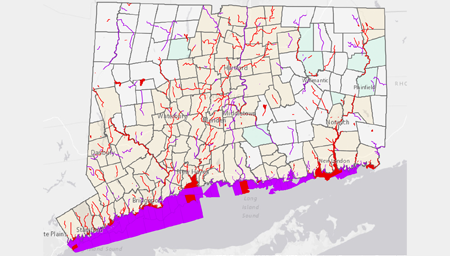
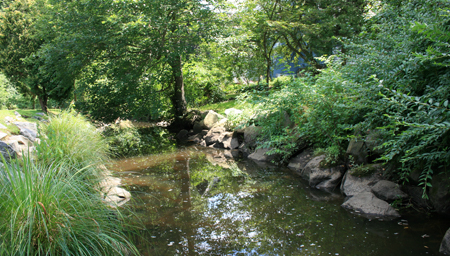
Riparian, or streamside, corridors provide a host of environmental benefits, from erosion control and wildlife habitat to water quality protection. What is the state of riparian corridors in Connecticut, and what options are there for addressing riparian corridor protection?
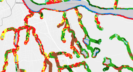
This webinar will focus on a recently completed CLEAR study showing changes to 100 foot and 300 foot riparian corridor areas during the 21-year period from 1985 to 2006. We will review statewide, watershed, and town-level data, and demonstrate the use of the project website. We will also present information on the functions and values of riparian corridors of various widths, the relationship between wetlands and riparian corridors, and the need for local commissions, land trusts and other conservation groups to work together on the conservation of these critical areas.
March 2, 2010
Presented by Cary Chadwick and Chet Arnold, UConn CLEAR
On March 2, A CT ECO Training Webinar demonstrated the range of data, tools and techniques for viewing Connecticut's natural resource data in the CT ECO (Environmental Conditions Online) website. Highlighted features included CT ECO's Data and Resource Guides, Map Catalog, Simple Map Viewer, Advanced Map Viewer, and Map Services. The webinar demonstrated how CT ECO is intended not only for the GIS proficient, but also for a casual map user. This webinar is no longer available for viewing.
In June of 2017, a newer webinar demonstrating the latest features of the CT ECO website was presented. This webinar highlights the new features of the site and how to navigate it.
CT ECO is a partnership between the Connecticut Department of Environmental Protection and the University of Connecticut.
January 20, 2010
Presented by Presented by Cary Chadwick, UConn CLEAR
This webinar demonstrated how anyone can use Google tools to publish basic geographic information on a customized map using Google Maps and Google Earth. It also covered techniques for embedding an interactive map on a website.
This webinar is no longer available for viewing.
November 4, 2009
Presented by Chet Arnold, Tom Worthley, James Hurd and Emily Wilson, UConn CLEAR
CLEAR researchers developed a model to analyze the land cover change for information on the fragmentation of forest land, the largest component of Connecticut's land cover. The Forest Fragmentation Study webinar is no longer available for viewing. Visit the Forest Fragmentation study and website for more information on this project.