
College of Agriculture and Natural Resources
Center for Land Use Education and Research

When modeling forest fragmentation, we are only interested in two classes of land cover pixels: (1) those classified as forest cover and, (2) those pixels causing the fragmentation. In the case of our forest fragmentation results, forested features are a combination of the deciduous forest, coniferous forest, and forested wetland pixels from the land cover map. The remaining land cover categories are considered the fragmenting features (except water which is not considered in the analysis, that is, water is not considered a fragmenting feature).
 |
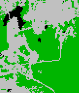 |
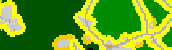
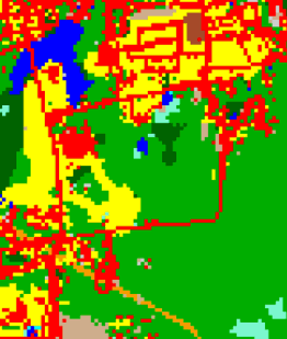
| 12 category land cover map | Forest Cover Map. Forest land cover is green, fragmenting land cover is gray, water is black (not analyzed). |
Below is an example of the result of applying the forest fragmentation model to the Connecticut’s Changing Landscape land cover using a 300 foot distance from a nonforest feature to determine where Core Forest begins. Since the land cover is derived from Landsat satellite imagery, which has a spatial resolution of 30 meters (approximately 100 feet), the Perforated Forest and Edge Forest will be approximately 3 pixels wide. Patch Forest will not be found adjacent to Core Forest. Also, the Core Forest has been broken down into three size categories representing Core Forest areas less than 250 acres (small core), Core Forest areas between 250 and 500 acres (medium core), and Core Forest areas greater than 500 acres (large core).
 |
 |
 |
 |
 |
 |
