
College of Agriculture and Natural Resources
Center for Land Use Education and Research

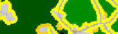
Based on the input forest cover map, the forest fragmentation model categorizes the forest pixels into one of four types: core forest, perforated forest, edge forest and patch forest. In running the model, we use a 300 foot distance to determine where core forest begins. The forest fragmentation categories are described in more detail below.
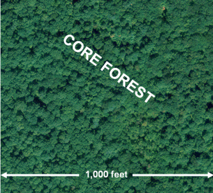 |
Core Forest – Forest pixels that are relatively far from the forest/non-forest boundary. Essentially these are forested areas surrounded by more forested areas. In the case of the forest fragmentation results presented here, the core forest must be greater than 300 feet from the forest/non-forest boundary. |
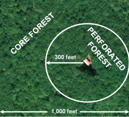 |
Perforated Forest – Forest pixels that define the boundary between core forest and relatively small clearings (perforations) within the forested landscape. In the case of the forest fragmentation results presented here, the perforated forest must be within 300 feet of a relatively small forest clearing and adjacent to core forest. |
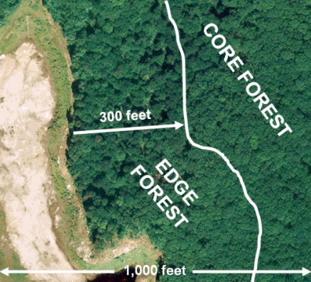 |
Edge Forest – Forest pixels that define the boundary between core forest and large non-forested land cover features. In the case of the forest fragmentation results presented here, the edge forest must be within 300 feet of a large non-forest land cover feature and adjacent to core forest. |
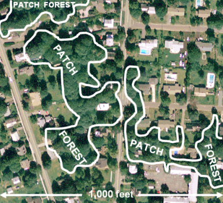 |
Patch Forest – Forest pixels that comprise a small forested area surrounded by non-forested land cover. In the case of the forest fragmentation results presented here, the patch forest cannot be adjacent to any core forest pixels, that is, patch forest pixels must be completely isolated from core forest pixels. A patch forest must be within 300 feet from a nonforest land cover feature. |
![]()
![]()
