
College of Agriculture and Natural Resources
Center for Land Use Education and Research

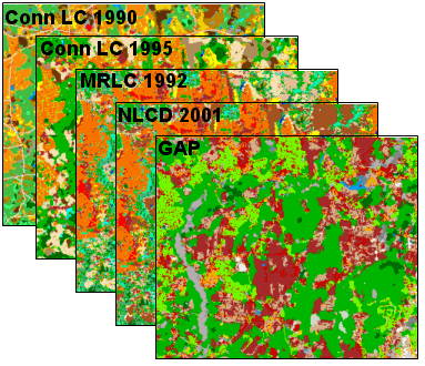
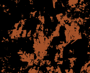
First, five existing land cover maps were compared to identify agricultural areas. If the land cover was agriculture in three or more dates AND Other Grasses in Version 1, the pixels were labeled as Agricultural Field.
 |
 |
Next, all areas identified as Agricultural Field were examined on top of high resolution imagery. Those areas that were wrongly classified were flagged and changed on the final Version 2 Land Cover.
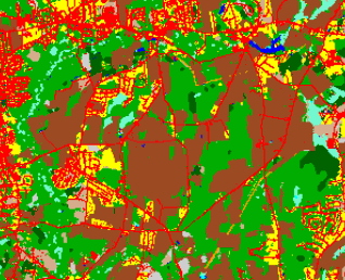
Even though agriculture is a Land Use and this is a Land Cover map, we feel that the land cover maps do a very good job at identifying fields that have high likelihood of being used for some sort of agricultural practice.
