
College of Agriculture and Natural Resources
Center for Land Use Education and Research


Riparian Zones | Land Cover Data | Change Maps
Riparian Zones
CLEAR researchers created a seamless, continuous “object to be buffered” GIS data layer. This “to be buffered” feature includes wetlands and waterbodies contiguous with the stream lines. For example, along the coast, the riparian areas studied begin at the outer edge of the tidal wetlands, not at the stream edge. This provides a more complete picture of development pressures infringing on water resources. Inland wetlands and small waterbodies not directly connected to the stream lines as determined by the state data layers were not included in this study.
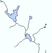
A. The "to be buffered" lineUsing the hydrography network and waterbodies, a "to be buffered" line was created (black). For lines, the buffer zone exists on both sides. For waterbodies, only the outside is included in the buffer zone. |
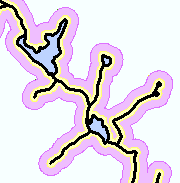
B. Buffer zones
|
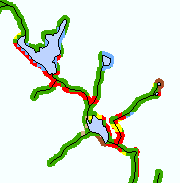
C. Land cover within the 100 foot zone1985 and 2006 land cover was extracted from the 100 foot zone. This allowed the land cover within the buffer zone as well as the land cover change within the buffer zone to be calculated. |
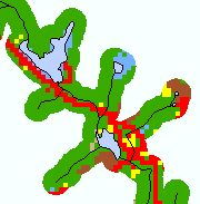
D. Land cover within the 300 foot zone1985 and 2006 land cover was extracted from the 300 foot zone. This allowed the land cover within the riparian zone as well as the land cover change within the riparian zone to be calculated. |
 |
 |
 |
 |
Land cover analysis was conducted using medium-resolution satellite-derived land cover data from CLEAR’s Connecticut’s Changing Landscape project, which has created land cover datasets for 1985, 1990, 1995 and 2002 and 2006. For this study, only 1985 and 2006 were used, creating a record of land cover change over the entire 21-year study period. Riparian corridors were characterized for land cover and land cover change for both 100 feet and 300 feet to either side of the stream. Since the land cover data is in the form of 100 foot by 100 foot pixels, the 100 foot corridor analysis involves a very small sample size, which CLEAR researchers feel approaches the limit of the appropriate use of medium resolution data; however, since the 100 foot corridor encompasses the regulated review zone in most Connecticut towns, the Center thought it worth investigating.
The 1985 land cover and 2006 land cover were compared to find areas that differed between dates. Because so many potential changes can happen, the changes were simplied. For example, if an area is water in either 1985 OR 2006, it will be water on the change map. Four change to (colored areas) classes are displayed, including change to developed, change to turf and grass, change to other grass and change to agricultural field. The change maps do not show what land cover was lost (in other words, from). We retained "no change" areas (grays) to provide context of the changes.