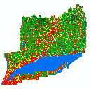
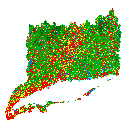
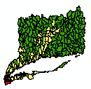
Please be sure that you understand the data and its appropriate (and inappropriate) uses. Visit the About the Project page for more information about how the maps were produced, metadata information, frequently asked questions, cautions about how to interpret data and for land cover category descriptions that explain what each land cover class represents.
All data are Connecticut State Plane NAD83 feet and are zipped. You must have winzip to extract the files. Get winzip for free.
Looking for shapefiles? We do not provide them here, but have some information and instructions below.
The following zip files contain .img files. If prompted by your software to create pyramid layers, say "yes" as they will increase drawing speed.
 |
Entire Area covered by Land Cover |
1985 (3.2 Mb) |
1990 (3.3 Mb) |
1995 (2.9 Mb) |
2002 (3.4 Mb) |
2006 (3.5 Mb) |
2010 (3.7 Mb) |
NA |
NA |
 |
Area belonging to the Long Island Sound Watershed |
1985 (2.8 Mb) |
1990 (2.8 Mb) |
1995 (2.8 Mb) |
2002 (2.9 Mb) |
2006 (3.0 Mb) |
2010 (3.0 Mb) |
Change to Developed (2.3 Mb) |
Change From (2.7 Mb) |
Imagine format (*.img) |
1985 (1.6 Mb) |
2006 (1.7 Mb) |
2010 (1.7 Mb) |
Change to Developed (1.5 Mb) |
Change From (1.5 Mb) |
 |
ESRI Shapefile (*.shp) |
Attributes by HUC12 Basin: 1985, 1990, 1995, 2002, 2006, 2010 Impervious Area and Percent Estimate, 1985-2010 Change Area and Percent Estimate (4.2 Mb) Zip file includes layer files with attribute aliases. |
We do not provide shapefiles for this version of land cover primarily because of the large file sizes and also because it is so easy to do the conversion in ArcMap. See instructions below. Before doing the conversion, be sure you actually need shapefiles. For simple viewing and analyses, the rasters work as well, and sometimes better than shapefiles. If you are still having trouble or have questions, email us at clear@uconn.edu.
It is easy to convert these raster files to shapefiles in ArcMap. We highly recommend doing the conversion on small geographic areas. Statewide land cover shapefiles are unwieldy to work with and are very large files (200 MB+).
First, download the raster files from this page.
In ArcToolbox, locate the Conversion Toolbox and the From Raster Tools.
Open the Raster to Polygon tool.
Select the Input raster file.
Select the Field. We recommend selecting Class so that the attribute table will have both gridcode and class_name. If you select Value, that works too.
UNCHECK simplify polygons. That's important.