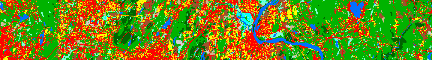
The Connecticut land cover and land cover change covers all of Connecticut. The project includes land cover from 1985, 1990, 1995, 2002, 2006, 2010 and 2015. There are two 1985-2015 land cover change maps - a change to and a change from. The land cover is summarized by each of the state's 169 municipalities in the map viewer and on the data visualizations. Riparian land cover and watershed-based impervious estimates, both of which cover Connecticut, can be found on the Long Island Sound Watershed section of the website.
This project was funded by the federal/state partnership Long Island Sound Study (LISS), a National Estuary Program. It is intended to give resource managers, researchers, and the public information about the way the landscape draining into the Sound has changed over the time period from 1985 to 2015. Because this time span is approximately the same as that of the LISS itself, it is a particularly apt dataset for those seeking insight into the land use-derived challenges to the health of the Sound, and our joint progress toward meeting these challenges. This study is an update and a geographic expansion of CLEAR’s Connecticut’s Changing Landscape project, which has been ongoing since 2004.