Presented by the Connecticut Land Conservation Council and UConn CLEAR.
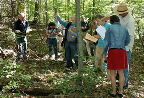
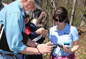
This one-day introductory training will cover the basics of using a iOS or Android phone or table to collect field GPS data for improved conservation easement monitoring and enforcement. Learn how to map property boundaries and specific locations that can be revisited year after year to determine and record compliance with easement restrictions. The skills learned are also applicable to fee property stewardship, including monitoring of boundaries, and mapping trails or areas for management activities. Course participants will be taught how to collect fielddata using personal mobile devices and upload GPS data to interactive online maps that can be saved, shared and embedded on land trust websites.
The course includes the following modules:
Registration & Details
The class size is limited to 16 students. This workshop is being offered in conjunction with the Connecticut Land Conservation Council (CLCC).
Upcoming class registration can be found on the Schedule & Registration page.
More information about smartphone Apps and GPS resources can be found on our Smartphone GPS Mapping page.