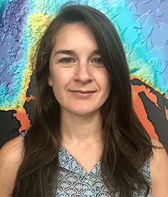
Cary Chadwick, Geospatial Extension Educator & GTP Program Coordinator
Emily Wilson, Geospatial Extension Educator & Geospatial Technology Specialist
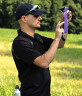
Dave Dickson, Extension Educator & Mobile Mapping Guy

Geospatial Extension Educator & GTP Program Coordinator
cary.chadwick@uconn.edu
(860) 345-5216
Cary Chadwick joined the University of Connecticut’s Center for Land Use Education and Research (CLEAR) team in 2006 as a member of the Geospatial Training Program. As a geospatial educator, her role is to contribute to the hands-on technical training classes offered by the program on the use of geographic information systems and global positioning systems. Cary is also actively involved in a number of collaborative research projects that integrate geospatial technologies to better manage and understand natural resource systems.
Cary is a graduate of Gettysburg College with a B.S. in Environmental Studies. She also holds a M.S. in Environmental Science from the University of New Haven.

Geospatial Extension Educator & Geospatial Technology Specialist
emily.wilson@uconn.edu
(860) 345-5226
Emily Wilson is a Geospatial Educator at CLEAR. Since joining UConn in 2000, her role has been to provide GIS and remote sensing information and support to CLEAR programs including the NEMO Program, the Geospatial Training Program and other related research and outreach efforts. Emily does a significant amount of work on the CT ECO and CLEAR websites with the goal of providing easy access to geospatial information and maps.
Emily is a graduate of Connecticut College with a BA in environmental science and botany. She received her M.S. in forestry and remote sensing from the University of Maine.

Extension Educator & Mobile Mapping Guy
david.dickson@uconn.edu
(860) 345-5228
Dave Dickson is a faculty member of the UConn Center for Land Use Education and Research (CLEAR) and an Associate Extension Educator in the Department of Extension in the College of Ag, Health and Natural Resources. As the Co-Director of the NEMO program at CLEAR, he works primary on municipal stormwater management and low impact development issues, but also provides outreach and training focused on mobile mapping technologies as a member of CLEAR’s Geospatial Training Program. He is the co-creator of the Rain Garden smartphone app and National LID Atlas. When pressed, or convenient, he will admit to being a lawyer by training, although not by practice or inclination.