Phragmites australis - Threats to tidal marshes of the lower Connecticut River

Locations

This page provides links to infomation about the areal extent of Phragmites australis in 1968 and 1994 within tidelands of the lower Connecticut River. To view a site, move the mouse over the index map below and click with the left button.
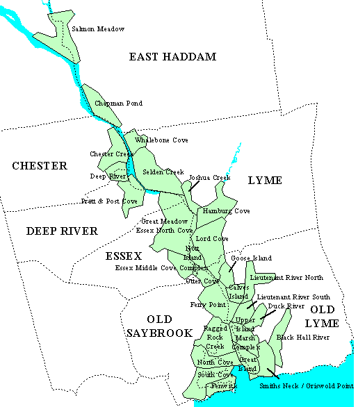
Salmon Meadows Chapman Pond Chester Creek Whalebone Cove Deep River Pratt and Post Coves Selden Creek Great Meadow / Essex North Cove Joshua Creek Hamburg Cove Nott Island Essex Middle Cove Complex Lord Cove Otter Cove Ferry Point Goose Island Calves Island Lieutenant River North Lieutenant River South Duck River Upper Island Marsh Complex Great Island Smith's Neck / Griswold Point Black Hall River Ragged Rock Creek North Cove South Cove Fenwick

These data originally were prepared by Dr. Nels Barret (NRCS) and Sandy Prisloe (UConn) with funding support from the Connecticut Chapter of The Nature Conservancy and the Connecticut Department of Environmental Protection, Long Island Sound License Plate Fund.