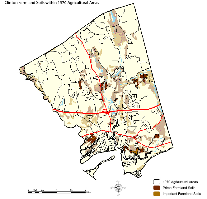
he map below depicts the locations of prime farmland soils and farmland soils of statewide significance as mapped by the USDA NRCS. Farmland soils that were also used for agriculture in 1970 are shown in bolder colors while those outside agricultural areas are lighter in color. Approximately 11% of the area of Clinton (~1116 acres) was mapped as prime farmland soils and 7% (~695 acres) of the town was mapped as farmland soils of statewide significance. Only 8% of the town's total farmland soils were used for agriculture in 1970. Click here to download a PDF file that depicts these soils data and that also shows areas used in 1970 for agriculture. (Note: the PDF file is best viewed using Abode reader 7. It contains layers of map data that can be turned on/off for visualization purposes.)