
College of Agriculture and Natural Resources
Center for Land Use Education and Research

 Riparian Areas
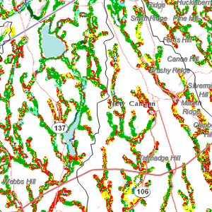
The term riparian refers to the land immediately adjacent to water bodies such as streams, ponds and lakes. These areas are known to provide a number of environmental amenities, including wildlife habitat, temperature moderation, and processing of pollutants. Riparian land cover has been identified in studies to have a relationship to the health of the waterways which they border. Our riparian study focuses on land cover and land cover change data for these important areas, in this case for the strip of land approximately 300 feet to either side of the study area’s waterbodies; 300 feet was chosen as a compromise between the immediate streamside areas that are often of interest and the ability of our 30 meter resolution data to generate meaningful data. More on our technical methods can be found here.
Visit the Connecticut Sea Grant/CT NEMO website on riparian corridors for information on:
Visit the Long Island Sound Riparian Toolbox for a wide range of resources on protecting, managing and regulating riparian areas.
