
College of Agriculture and Natural Resources
Center for Land Use Education and Research

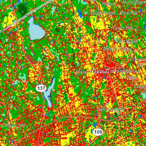 Land Cover
Land cover depicts what is physically on the ground, such as forest, grass, developed land, etc. There is an increasing body of scientific literature relating land cover of several types to the health of watersheds and the waterways that drain them. Our land cover data is derived from the Landsat series of satellites and is in 30 meter (100 foot) squares, or pixels. Thus, it is appropriate for town, watershed and regional studies, but is not sufficient for very small areas like neighborhoods or parcels. We have simplified our land cover into 8 categories, which are used to characterize the landscape at certain points of time, and to calculate change between those points – in this case, for the entire study period of 25 years, 1985-2010.
Class Descriptions including Change
Visit the Connecticut's Changing Landscape About page to learn about:
Visit What We're Measuring to learn about:
