
College of Agriculture and Natural Resources
Center for Land Use Education and Research

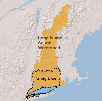 This website provides maps, statistics, and other information related to landscape change in the lower drainage basin of the Long Island Sound for the 25-year period from 1985 to 2010. While the watershed of the Sound extends northward all the way to the Canadian border, our study area is limited by the available data but encompasses all of the portions of Connecticut and New York that drain to the Sound (right). Land cover, what’s physically covering the ground, can tell us a lot about the impact of land use on the Sound and other water resources. There’s a lot here, so we hope you’ll be able to spend some time!
- Land Cover Maps
- Riparian Zone Maps
- Basin (HUC12) Statistics
- Summary Maps by Basin (HUC8)
